Comments from Piers
WeatherAction

WELCOME to WeatherAction !
26+27th Massive Storms developing in WeatherAction 'R4' 26-27th
Br+Ir+Eu (maps below)
Xmas Offers now ended.All Winter Months Dec+Jan+Feb £30, Eu30, $30for B+I 45d, Eu30d, USA 30d CONTINUES
24 + 25 Dec Happy Xmas
Current Weather Commentary
[HURRY GO FOR WEATHERACTION FAB XMAS POPULAR OFFERS (below).
Don't lose out DO IT NOW! Thank You Offer closes 24:00 Xmas day (00hr 26th) - Offer Closed]
Xmas day
Brit+Ire+Europe
AMAZING! match between WeatherAction Forecast 6 weeks ahead for ~27th Dec and Met Office short range.
"This storm is in another of our Red Warning R4 periods. This will be big and dangerous - with STRONGER WINDS THAN METO WILL EXPECT FROM eg 26th. There is more to come after this one too", said Piers Corbyn astrophysicist WeatherAction.
YOU NEED to subscribe to WeatherAction if you dont already!


24th Brit+Ire+Eu
Forecast users will have noticed that while our forecast for ~21-24th Dec (LOW confidence, 70%) correctly predicted very mild conditions Br+Ir and less mild later in N/W, the winds were underestimated.
Nevertheless (and well done Rohan winter subscriber, Croydon - see Comms below) forecast users applied the WeatherAction Rule that WHATEVER the forecast outcome detail in an R4 or R5 the standard Met forecast winds will need enahncing - That was confirmed.
The quieter 24-25th (No significant solar factors) looks like being confirmed.
Subscribers to 45d Br+Ir or Eu will notice the remarkable similarity between MetO for Frid 27th and WeatherAction dartboard Low forecast.WITH THE NEW R4 THIS SPELLS DANGEROUS WEATHER ON FRIDAY 27th. WATCH THIS SPACE . We will also discuss what is coming around New Year's Eve / Day
25th & 24th USA forecasts
in run-up to Xmas and Xmas itself have been turning out excellently (see Comms from users).
Sudden Stratospheric Warming breakthrough
Thanks to all for passing on this news - please continue. This is a very important advance
23 Dec
FORECAST TOTAL MUST GO-4-IT BONANZA 22-25 Dec
=> ALL 30d services - Br+Ir, Eu, USA - from 22nd give rest of Dec FREE and subscription payment starts JAN.
This is vital for all in USA, Brit+Ire and Europe as Top Red 'R4' and 'R5' solar-weather periods ramp up travel chaos.
=> ALL Services 12months for 8 - offer ends on 25th <= Double top value till First night of Xmas! THANK YOU! say subscribers "This is the smartest prez in town!"
=> AND NEW on 23 Dec - Do it now
LOYALTY BARGAIN (9m for 5.5) FOR EXISTING SUBSCRIBERS, ANY SERVICE
If you have some of a sub to run you might wish for somethinmg like one of these Xmas deals.
Here's the answer for any WeatherAction service you are subbed to;
Get a 6 month sub (charge 5.5m) and we EXTEND YOUR EXISTING SUB by 9 month
We have all details so that's all you need do. [Offer closes like others on first night of Xmas / when shown on site if update delays]
Latest Weather NewsMain Headlines:
"ABSOLUTELY OUTSTANDING" Forecasts for SE Canada (Montreal-Ottawa-Toronto) says Robert-Michel of Montreal re ~21-22 and snow hit 18-20 also forecast by WeatherAction and Worst Ice-storm ever says Toronto-Hydro. Report+pics for USA and South Canada 21-24th Dec section of December WeatherAction forecast issued 29Nov below.
Britain & Ireland Keep Close Watch on activity changes in next few days espec 24-25th and see updates. Interesting discussion below and in blog.
"Jet Stream Record speed a fingerprint of mini-ice-age"
says Piers Corbyn, astrophysicist of WeatherAction.com
"The record 275mph Jet Stream speed over the North Atlantic on 22nd Dec (below) - reported on TV by Chris Fawkes BBC-MetOffice - accords with our predictions of increasing 'Wild Jet stream' behaviour as the world moves further into the Mini-Ice-Age circulation we predicted years ago. Significantly this record comes during the late Dec series of our 'Top Red ('R4' and 'R5+') Weather periods which we predicted in mid Nov (in Br+Ir 45d forecast). Related dramatic solar eruptions and Auroral displays will reach a crescendo around the turn of the year and recur during January***.
"Newly errupting active sunspot regions are coming round to be Earth-facing (below) when we predicted and will drive dangerous weather conditions around end Dec and start Jan in USA, Brit+Ire, Europe and the whole world. These events of course are nothing whatsoever to do with the delusion of CO2 driven climate change. Indeed the CO2 warmist protagonists admit they havn't a clue about why the jet stream is so wild whereas it follows totally from our solar-driven theory*.
"The innuendo 'It's extreme it must be CO2' is a lie. This 'Mini-Ice-Age increase in wild and extreme events will continue for the next 20 years* by which time the CO2 theory and associated carbon tax theft and dodgy and intelectually-strained politicians will be in the dustbin of history"
***Fuller comments are available in the FREE December Br+Ir forecast which comes now (since 22nd) with all subscriptions to Br+Ir forecasts 30d or 45d and is with the Special All Winter months super deals and the 12months for 8 Xmas Prez Bonanza offer which expires on the first night of Xmas.
* See Piers Corbyn's presentation to GAFTA (Grain & Feed Trades Association) Conference Geneva May 2013:-
Latest 23 Dec Upper stratosphere warming starting in line with Piers' revolutionary trial prediction (in Br+Ir 45d prod 15Dec) [for peak ~ Feb28-Jan1st (uncertainties)]:

Piers says "This is fantastic news - our, the world's first ever, Polar Upper Stratwarm prediction is coming true - another breakthrough for WeatherAction".
The Jet Stream and solar pics re above


https://twitter.com/TamithaSkov/status/414483368605007872/photo/1 on 21 Dec. Extra active region 1934 (and nearby ones) will be ~Earth-Facing in WeatherAction R4 and R5+ periods 29Dec-Jan2. (Further details in current Dec 30d and Jan 45d Br+Ir forecasts)
21 December Happy Solstice!
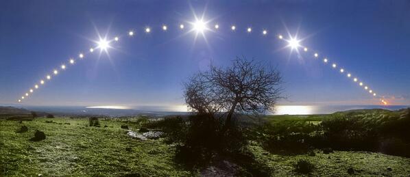
From @CumbriaWeather , @astrojenny: Happy Solstice! pic.twitter.com/NbqstKeZG9
Top Spot 20+21 Dec inc Current Weather Commentary
Get a WeatherAction Subscription Xmas prez for someone!
Send them Subscription USERNAME(Email) / Password with a copy of this WeatherAction Xmas E-Wrapper : below or http://twitpic.com/dpat2t/full

Special Xmas Offer to 25 Dec Only
ALL SERVICES
12month for charge of 8 x standard single
- See below and Subs page for detail
WeatherAction Forecast Subscriptions - THE Smart present of The Year
THERE's ONLY ONE PRESENT YOU SHOULD BE GIVING OR RECEIVING THIS XMAS!
=> WeatherAction All winter months Fab Offer for Br+Ir, Eu, or USA
The "single month" buttons now give access to the 3 winter months on issue for £30, Eu30; $30 respectively. (These are at least 1/3 off). Further info on subscribe button.
=> Sub for 6months for price of 5.5 (each service details via Subscription button)
=> New Xmas offer 12m for price of 8 single standard
This is for ALL Services including the already reduced 'The Lot' (ALL Web services)
THANK YOU to all new and re-newing subscribers to these three POPULAR offers and those who are getting 6m, 12m subs which are also great value and keep you ahead of the rest for longer.Offer open to 25Dec or when we update site if later.
THIS Winter is really important both sides of Atlantic IT WILL PAY YOU TO GET AHEAD OF THE GAME!
Also go there for UPGRADES
30d=>45d Extends current DEC 30d to JAN 45d+30d for only £10 (£10 per upgraded month)
45d=>75d Extends current DEC+JAN45d (inc30d) to Feb75d (inc all 45d, 30d forecasts); only £30 via Donate button
Xmas offer also applies to Upgrades
Why suffer in ignorance?
WeatherAction forecasts set the pace - miles ahead of all the rest of LongRange offerings in Newspapers, TV, and standard Met Computer models - Brit+Ire, Europe and USA
WeatherAction forecasts set the pace - miles ahead of all the rest of LongRange offerings in Newspapers, TV, and standard Met Computer models - Brit+Ire, Europe and USA
Latest Weather News
FOR MORE DETAILS SUBSCRIBE TO FORECASTS
Br+Ir+Eu - Will it or wont it? (issued 20th)
The forecast with weak wintry mix at present (~18-20th, R4, BC 70% confidence) is going well but although the weather, including hail and thunder in SE, as described in the forecast is about right the detailed pressure pattern of a moving "Low sandwich" has not really appeared. Instead we have greater mobility and not time for such a situation to be established. The pre (14-17) and post (21-24) periods have really merged. [USA monitors will note that such "Low sandwiches" have come in USA when we predicted although they are larger scale affairs.]
The greater mobility is drawing down more Upper/Arctic air in the tail of Lows and the 528mb Mb thickness (=> snow /sleet possible) covers much of Ireland and N England/Wales on MetO 24Dec noon forecast charts. Although the MetO remove these thickness areas from their maps nearer the time in their obscurantist ("Oh no we didnt say that we just didnt say") fashion that gives a good chance on their maps of some sleet or snow falling in some places (hit and miss) on Xmas Day (24hrs). HOWEVER set against that we have 'NSF' (No Specific Solar factors) on 24th and 25th which implies a slow down of development compared with this MetO forecast produced in the middle of the present R4. In which case the 528Mb thickness will keep further North & West. WATCH what happens in this interesting period.
THE MOST LIKELY OUTCOME OF SNOW/NO SNOW XMAS DAY Br+Ir (taking a compromise forecast) is, now (20th), that some places in North & West - eg Eire/NI, N Wales, NW England, Scotland - will get a smattering on some of the betting stations but none in other parts.
For information although we forecast a 'Green' (ie no snow likely in locations William Hill etc offer) I did not put money down in advance this year because of pre-Xmas low confidence of detail and because the odds are too short for 'Green' and so not in my normal betting policy.
USA + South Canada
The WeatherAction 3 week ahaead pre-Xmas disruption warning forecast
in order downwards of events (in this case).
See also 15 Dec News below - Jeff Glover Blog Comms of previous blog for excellent praises of earlier WeatherAction USA+CAN Forecasts
USA + CANADA continuing travel disruption and expected storm, snow and ice over weekend 21-22 superbly captured in WeatherAction USA forecast of 3 weeks ahead:

21 Dec AccuWeather Reports/short range for weekend 21/22 Dec in line with WeatherAction 3 weeks ahead - http://www.accuweather.com/en/weather-news/christmas-travel-snow-to-tornadoes/21156700

Photos and links 21-22 Dec USA + S Canada


After Ice-Storm night 21/22 Toronto Further dramatic pics and extensive report:
Recent Points and events of Note just prior to this BlogPost:-
WeatherAction Annual Xmas Open Meeting and Party FRID 20th Dec 2pm
Delta House, 175-177 Borough High Street, SE1 1HR
This was a great event - video extracts later
19 Dec
Br+Ir+Eu GALES & STORM FORCE WINDS - AGAIN. Damage = trees down and widespread electricity outages in Northern Ireland, Wales, North Britain espec Cumbria and Lancs 17-18th was as in WeatherAction B+I 45d forecast of 4 weeks ahead and repeated in 30d ahead for ~14-17th (+/-1d); Vid Report http://www.youtube.com/watch?v=mkqb96bhozw
(16/17/) 18 Dec Top Spot
=> WeatherAction Bri & Ire JAN 2014 full detailed 45d EXCITING! ASTOUNDING! forecast uploaded {and typo on 1-3 Jan corrected at 13:30Gmt 18Dec}
Piers says: "Subscribers will be really interested in this forecast both for the very important weather developments in Britain and Ireland with some notes on Europe and for the
extra solar and upper atmosphere forecasting now including Stratospheric warmings.
This is undoubtedly one of the most important forecasts ever produced by WeatherAction and I commend it and urge subscribers to convince others to also subscribe. Thank you".
=> WeatherAction Bri & Ire FEB 2014 "ESSENCE" 75d ahead forecast is now uploaded
This will be updated into '60d' at end of Dec. The 75d service ('Single' £60) includes everything in 45d and 30d.
IF YOU WANT JAN AND FEB NOW and have already subscribed to the All Winter months B+I deal; for £30 you can UPGRADE to 75d - including all 45d, and 30d. Just pay £30 via the donations button. We will see that and change your 45d service to 75d. This is the same total £60 as if you had subcribed first as 75d. Thank you
Note Publication of official public information from WeatherAction is welcome but forecasts are copyright and confidential to subscribers and small numbers of close associates. Unauthorised illegal circulation or use will be treated as a police matter. Thank you.
If you want to know where winter is going in Brit & Ireland these forecasts will help you. Various posted 'Comments' from bogus email addresses asking that question have not been published.
=> THANK YOU ALL for great feedback Brit+Ire+Eu & USA during this important R5 ~14-16th. (weather period 14-17th) Please pass on the success news to others who might then subscribe to the current ALL winter months offer for only (£/$/Eu depending which) 30.
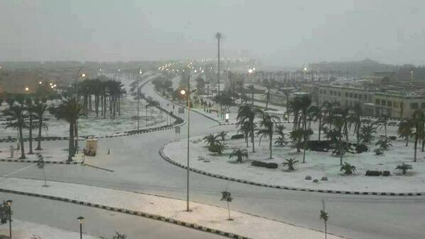
=> We have had an increasing amount of spam recently from warmist trolls who pretend the NH winter equates to the first fortnight of December in England. This nonsense comes while it snowed in Egypt (below), for the first time in 112 years it appears, LOL!
15 Dec 22:00hrs GMT 17:00 EST - A race for the very Top Spot
If you are from USA and considering subscribing you MUST read this luminously glowing rec from Jeff Glover USA
On 15 Dec 2013, jeff glover wrote:
Piers-me and many of my weather cohorts here in the U.S.A. follow your forecasts very closely and are most impressed with your professionalism but are particularly in awe of your accuracy regarding your long range forecasts pertaing to North America. A good friend of mine=Mr. Joseph Bastardi-has nothing but kind words to say about your forecasting. Most of my weather comrades are supporters of the fact that the Little Ice Age is knocking on the world's door and soon will be in full ecidence around the globe. they also believe as you and Mr. Bastardi belive that the co2 matter is an agenda driven fallacy. Keep up the great work-and oh by the way tomorrow I am commencing subscriptions with Weatheraction-as are some of my compatriots. Jeff G from the great State of Washington
Piers says: "WOW, JEFF, THAT's MAGIC. Without subs we are nothing. It's especially an honour to get a good word from Joe B, who after all - if the weather machine were an old-fashioned petrol driven racing car - would be THE TOP MECHANIC who knew every cog and trick, maybe not why it did things but how it does them. Hence his superb grasp of what weather models do and do not do and medium and medium-long range forecasting.We currently only have a tiny % of even farmers subscribing in UK, Eire, Europe or USA+near Canada. We need to get more USA + Canada subscribers for whom weather is a serious matter and then expand into longer range including more of Canada and then further expand numbers to a tipping point where a substantial % of people seriously business-affected by weather subscribe. Then we'll all be motoring!
15 Dec 13:30hrs GMT At the (now almost) very Top Spot
| RadioYork interview is on http://www.bbc.co.uk/iplayer/episode/p01lswz0/Paul_Hudsons_Weather_Show_14_12_2013/ Piers starts at 42 mins in. |
||||
Piers says: "Thanks for listening, if you did, to my interview by Paul Hudson on his "BBC Radio York" (get recording via internet) Weather Show today Sun 15 Dec. Paul is a great interviewer, gave very positive views on our success rates and enabled me to get some good points across. One point left out - possibly because of the strength with which I made it - was my comment on the Daily Express weather Headlines (other than an implied view near the start of the interview) - which I described as 'Foolcasts not Forecasts'.
My first extensive and substantial snow of winter ~NYEve / NYDay statement, does not mean some more confined and limited even if briefly heavy and blizzardy in wind on mountains with some lower level smatterings before that has been ruled out. Such are still likely but my Xmas onwards comment was about substantial and extensive amounts which should settle (not a point asked about but that is important).
If you want more forecast information please subscribe below. All forecasts include the present month, eg when you subscribe to 15-45day ahead or for the 3m offer or 6/12months. How about getting a Sub for a friend for Xmas!
Thank you".
Please use Comment form at foot of this post for feedback/questions/comments.
Business Questions/Comments here will not generally be published unless you ask or say you want that. Please indicate your intention - publication or not - for any such comment/point.
Standard information See end of blog for
RULES for User/ Reader/ All/ Your Comment & Feedback (bottom of blog)
Useful Links to other sites
Latest video news links - Piers Corbyn WeatherActionTV, Nigel Farage UKIP
Samples, Skill and Usefulness
For samples of any past forecasts (eg last few months) go to: http://www.weatheraction.com/pages/pv.asp?p=wact46 The first letters indicate the region of the forecast:BI, Eu, USA....
For Forecast Accuracy, applicability and subscriber recommendations go to: http://www.weatheraction.com/pages/pv.asp?p=wact45
For Forecast Accuracy, applicability and subscriber recommendations go to: http://www.weatheraction.com/pages/pv.asp?p=wact45
For recent user live assessments, recs & notes also see blog comments in previous blog.
Info: R5 ~14-16Dec both sides of Atlantic
For Top User Comments on developments see Dec 15th, Bob Weber N Michigan USA; Craig M, Berkshire UK in Comms at foot of previous BlogPost and Bill Smith and Dave quoted in text below.
Sat 14th Dec Special 'End-Game' storm Warning Br+Ir+Scandinavia

Shortly after posting the warning below someone posted on twitter words to the effect
"It looks like a normal winter Wet & windy event"
Piers says: "This twitter-er needs to wise-up. We do not make forecasts by using standard Met maps that is precisely what we do NOT do. We "see" them and say how they need to be modified in general terms. Or to be more precise well ahead of when they are produced (29days in this case) we know the basic things they will suggest AND HOW THEY WILL BE WRONG in certain circumstances (eg R5s)"
Later WeatherAction site got postings (as in Comms below):
Bill Smith Applecross Peninsula is just East Of The Isle of Skye
Dave
HOWZAT!
- commenting on Standard Met short-range forecasts (normally of storms long range warned by WeatherAction).
After Forecast Map Newest News on Top
Forecast map of 29days ahead.
Note the graph page in fullforecast shows mild over w/e 14-15 and colder 16-17th and EU forecast shows Storm track towards N/Centre Scandinavia (Not a diving Low which can give N Sea storm surge)
STORM FORCE WINDS WERE CONFIRMED..
Shortly after posting the warning below someone posted on twitter words to the effect
"It looks like a normal winter Wet & windy event"
Piers says: "This twitter-er needs to wise-up. We do not make forecasts by using standard Met maps that is precisely what we do NOT do. We "see" them and say how they need to be modified in general terms. Or to be more precise well ahead of when they are produced (29days in this case) we know the basic things they will suggest AND HOW THEY WILL BE WRONG in certain circumstances (eg R5s)"
Later WeatherAction site got postings (as in Comms below):
Bill Smith Applecross Peninsula is just East Of The Isle of Skye
| I see that Applecross peninsula recorded 102 mph ,and further east Tomintoul area recorded 111mph today........... |
Dave
| Your forecast for 14th-17th is playing out in from of my eyes, including the thunder and lightning (not terribly common in Dunfermline. Well done Piers!. |
HOWZAT!
As Issued 1300 Gmt 14DEC WeatherAction STORM WARNING 14-15Dec Br+Ir+Eu.
BBC-MetOffice (Standard Meteorology) FORECASTS HAVE PROBABLY UNDERESTIMATED COMING STORM - Double hit: 14-15th and another hit later on 15th.
Gusts over 90mph are likely (MO on BBC put tops at 80mph in fc issued Sat lunch). Red Warnings should be issued. WeatherAction R5 (Top Red) period here is ~14-16th.
This follows on the heels of MO underestimating wind strengths in:
(i) 'Piers storm Oct 28th' for SOUTH Br+Ir + near continent [which was first announced as a serious late October storm by Piers 23 weeks ahead to GAFTA Conference Geneva - WANews43 via 'latest' on WeatherAction.com home page]
(ii) The 5 Dec N track - 'Diving Low' giving wind damage on land and some coastal flooding with biggest coastal atatcks in Denmark-Nth Holland. (Detailed forecast in WeatherAction 45d ahead released 29days ahead)
THIS IS NOT THE LAST STORM THIS DECEMBER WHICH STANDARD MET WILL UNDER-ESTIMATE.
Full details in WeatherActiob 30d (and 45d) Br+Ir and Europe forecasts via Subscriber link above.
Don't suffer in ignorance - Subscribe!
LIVE FORECASTS
USA Maps Developments & extremes 30d, DEC 2013
10 pages, is in: USA Maps 30d (extreme Events); and 'THE LOT' (All Web forecast); Services
Br+Ir 30d DECEMBER 6 page inc graphs+Maps is
in Br+Ir 30d, 45d & 75d and 'THE LOT' (All web forecasts) Services
IT'S ANOTHER MUST HAVE interesting Forecast from WeatherAction
Do not assume because you've read in papers or seen models of 'What December will be like' that WeatherAction is saying the same. As a fact WeatherAction LongRange forecasts are often different from all others and as a fact WeatherAction has proven peer-reviewed independent well monitored skill and profitable weather-bet results - unlike all the media and Long Range (10d+, 'seasonal') models - which have no skill.
Br+Ir 45d (January now) SERVICE 23 pages
Br+Ir Detailed 45d forecast inc graphs+Maps 6 pages
with Euro Pressure maps (9pages) Dec + RTQ Forecast (2pages) Dec
and current DEC 30d Br+Ir (6p)
Br+Ir 75d (February now) SERVICE 24 (=>26) pages
BR+Ir Essence of Feb 1 page - which will also be updated in more detail at 60d
PLUS ALL CONTENT OF 45d
Euro maps 30d service comprises 20 pages
- Euromap Regional forecasts - 9 pages
- Euro+ N Atlantic + Br+Ir Pressure map Scenario forecast - 9 pages {also in Br+Ir 45d & 75d}
- RTQ {Red ('R') active weather periods & Thunder/Tornado & Quake (Trial) risk} - 2 pages
Europe Extremes Only, 30d (edit of Region Maps) 9 pages
Europe Pressure Scenario maps 30d DEC 2013 9 pages is loaded into:Euoromaps 30d; Br+Ir 45d, 75d; The Lot - All Web forecastsPressure Maps this month include extra annotations about certain optional possibilities for Eu and Britain+Ireland.
Istanbul snow Pic added 13 Dec
Euro Map service comprises:

Anyone and new comers.
Welcome and Do get in touch with any questions / comments / speaking requests. Via the blog below for espec public comments (Please indicate) or via:
piers@weatheraction.com 02079399946 / 07908734296.
Get ahead of the rest with WeatherAction -
- world leaders in long range weather forecasting.
LATEST WeatherActionTV and News VIDEOS
The CO2 Warmist are on the Run - Time to finish the Job
DECISIVE: Piers Corbyn dismembers the UN Climate Committee report meeting held at the Royal Society 2-3 Oct 2013 => Weather Action TV Report Sept/Oct 2013 - UN Climate Report - A Disgrace to Science http://www.youtube.com/watch?v=JsAlxTL4QeM
Short link = http://bit.ly/1fNK2mv
RELENTLESS: Nigel Farage leader of UKIP nails the Global warming Lie at the European Parliament http://www.youtube.com/watch?v=PwMOsocu5Rg
Short link = http://bit.ly/Ip1sqZ
++++++++++++++++ Standard Material below ++++++++++++++
What are WeatherAction Long Range forecasts?
WeatherAction Long-Range forecasts are entirely different from all others.
They are produced using scientific advances in understanding predictable aspects of particle-magnetic effects from the sun which, along with lunar factors, change world weather systems in ways which have generally happened before. Through this approach WeatherAction can predict many key changes on the sun and associated changes in circulation, the Jet Stream and weather events with independently proven skill and unrivaled reliability (See Forecasts/ Accuracy button). Standard Meteorological approaches of forward projection of the present state of the atmosphere acting upon itself fail beyond a week or so ahead because they ignore external solar influences and so will never succeed.
WeatherAction LongRange forecasts are not 'early' substitutes for short range forecasts.
They are intended to help decision making well ahead of events for which advance planning, like booking harvest machinery or gaining advance knowledge of likely energy prices, is a NECESSITY - in situations for which short range forecasts would be too late.
For this reason WeatherAction does not normally give detailed Short Range updates because such are 'too late' for the use of subscribers; although for major events we do comment on how short range standard meteorology forecasts are likely to be in error on occasions. FOR MORE SEE AN EARLIER BLOG: http://bit.ly/1a9rD0l
Past WeatherAction forecasts available in Forecast Archive
http://www.weatheraction.com/pages/pv.asp?p=wact46 for ALL AREAS - Brit & Ireland, Europe, USA and 'RTQ' (Red Warnings, Thunder-Tornado & Sudden Polar Strato-warms in season, Quake risk) Aka World Extreme Events. Now updated to cover all seasons - including all forecasts produced Dec 2012 to NOVEMBER 2013 (and many prior to that). Go, See what we said before anyone else!
LINKS to important Weather & Climate & other sites
IceAgeNow http://iceagenow.info/ - Superb exposes of CO2 delusions!
WeatherOnLine: http://bit.ly/SMecq7 - ECMWF, GFS model movies &c (Don't take literally!)
ClimateRealists (Twitter) https://twitter.com/ClimateRealists
1stHandWeather (USA+World) https://twitter.com/1stHandWeather
Wunderground Tropical Cyclones http://www.wunderground.com/hurricane/
TallBlokeWeather-SolarScienceBlog http://tallbloke.wordpress.com/
CraigM TopWeatherObs+Analyst http://craigm350.wordpress.com/
AccuWeather (USA+World) http://www.accuweather.com/en/weather-news
NationalHurricane Centre http://www.nhc.noaa.gov/gtwo_atl.shtml
Fixing Computers! http://www.brainboxcomputers.co.uk/
BigJoeBastardi https://twitter.com/BigJoeBastardi Top model watcher & AGW critic
https://www.facebook.com/pages/Torro-the-UKs-Tornado-and-Storm-Research-Organisation/249176491778442
LINKS Latest Solar-Geomagetic activity data -: SpaceWeather.com:
http://spaceweather.com/archive.php?day=05&month=09&year=2013&view=view choose day
USGS Earthquake Reports http://earthquake.usgs.gov/earthquakes/search/ (Warning: overly complicated and 'clever' if you just want simple information, since it was 'improved'. Useful summary links have been discontinued)
Sunspot numbers and Solar Activity
Last 6 cycles up to now (19-24 inc) http://sidc.oma.be/sunspot-index-graphics/wolfmms.php
Plot since 1700 http://sidc.oma.be/sunspot-index-graphics/wolfaml.php
General SIDC (Solar Influences Data Analysis Center) Link
http://sidc.oma.be/sunspot-index-graphics/sidc_graphics.php
READERS COMMENTS & FEEDBACK RULES
THIS Site is DEFENDED SPACE - 100% Moderated and troll-free because of ongoing cyber flood attacks and to stop postings not of fair and honest intent and to engage in fruitful discussion.
THANK YOU for the many well informed comments on this site.
All fair comments including critical points are published.
Exceptions to publication are:
- pharmacy-obscene-spam, obscene terms, product and service promotion-spam and libel (Note WeatherAction publishing site as well as original libels are culpable since publication was allowed).
- Items which reveal paid WeatherAction forecast detail,
- Items which are in a large or central part false or rude (by accident or design) in which case writers may get a direct response, or be ignored.
- Items involving swearing
- Items which are irrelevant and/or trollish in which case they may be advised, or not, on where to go.
- Items from people who do not use real names and persistently do not provide an e-mail address may be ignored depending on the circumstances.
NOTE We normally REQUIRE proper contact information for anyone making or claiming to make Observational Reports specific or general. We have had a number of instances of questionable 'information' being offered from 'no contact' or people purporting to be subscribers who are not.
THE KITCHEN TEST. This web site is not a public place for unconstructive exchange and false accusations but more like a personal kitchen. So if you sent in something that was ignored (note we publish almost everything) ask yourself if someone walked into your house and kitchen and said what you said or implied would you let them stay or send them out.
When commenting please say whether you are a subscriber or not and give your approx address / location (or precise location and Obs time if giving a weather report!).
When commenting on a WeatherAction (or any) forecast refer to actual forecast words as far as possible because some summaries / notes circulated, reports of forecasts have been or can be misleading. Also include actual obs / web links where possible. Please give working links when you refer to other articles/sites.
THANK YOU