On 05 Sep 2016, Paddy (Aberdeen south, 130m elevation, sub) wrote:
13˚C at 7.30, overcast for most of the day, cool Sly breeze all day but when the sun did come out it nevertheless got to 20˚ max, down to 13˚ by 10pm. Sunny end to the day, MO is now saying 23˚ tomorrow.
On 05 Sep 2016, Mark Hall (Herts, UK) wrote:
Andy L.
I was in Sagada (Philippine Mountain Provence) in 1992 when there was a sizeable earthquake. What was strange was the immediate appearance of thunder cracks and lightning. And this was in the dry season so the coincidence was unlikely.
Sitting outside as the aftershocks dissipated, the jagged ridges sharpened by the menaces from above and below, some memories never fade.
On 04 Sep 2016, Paddy (Aberdeen south, 130m elevation, sub) wrote:
12˚C at 7.30, foggy until 10am, then suddenly brightening up to a lovely warm day with 21˚ max in spite of the NEly breeze that blew all day. Clouds bubbling up in between did mean a quick cooling by several degrees but the minute the sun came out it warmed up again. 12˚ at 9pm & foggy & still again. MO is promising 22˚ on Tuesday.
On 04 Sep 2016, Andy L (Cambridge) wrote:
Steve C: that's the weather photo of a lifetime and a scary photo to look at, never mind actually taking it! A reminder that weather can be beautiful, remarkable and deadly in (literally) one stroke! Any idea why lightning occurs in erupting volcanoes? Search for many great photos on the web. Some seriously weird physics going on there.
On 04 Sep 2016, Richard Brown, Hull, East Yorkshire wrote:
Another sideswipe at man's attempts to cook the planet....http://gizmodo.com/a-60-year-old-pattern-in-the-stratosphere-just-reversed-1786158830
The article claims scientists have no idea why it changed but do offer the suggestion that it might be to do with the massive El Nino we just had or, wait for it.....something to do with the climate getting hotter.
And so it goes on....and on.....
On 03 Sep 2016, Paddy (Aberdeen south, 130m elevation, sub) wrote:
12˚C at 7.30, bright start with some cloud which gradually thickened up during the morning, breeze generally from the SW and we still managed to get 21˚ here, mostly dry bar a few odd drops of rain in the afternoon, back down to 12˚ by 10pm, still dry so the rain forecast by MO this morning isnt going to happen; they, well, their computer, has changed the forecast at least 3 times during the day.
On 03 Sep 2016, Steve Devine wrote:
An hour of rain so far here in SW Essex and it's very welcome indeed considering the relatively dry August we've just endured. Back to work on Monday after a week's holiday and temperatures again rebounding into the mid to high twenties celcius. Personally and selfishly - I'm sick of it. An unseasonably warm winter last year and disgusting levels of humidity from July onwards makes commuting and sleeping unbearable. Bring on the storms that GFS promise us a fortnight from now I say. Signed, Victor "I don't be-lieve it!" Meldrew ;-)
On 03 Sep 2016, Gerry 45d Surrey-Kent border 223ft wrote:
Re - MetO forecasts, when was the last time they didn't forecast a warmer winter? With their belief that it is warming they have to keep pretending it is. Harabin's claim that it will be above 'pre-industrial levels' the words 'straw' and 'clutching' come to mind given that this refers to a period shortly after the last solar minimum. In the Paris deal China are classed as a developing country and don't have to do anything for decades so really had nothing to lose by signing. What they gain is putting pressure on the US to sign and commit to slowly strangling their economy. Thursday was another nice day but Friday brought some showers and a strong breeze but cleared to give a misty night. Today has been cloudy after a bit of morning sun and some showers coming through. Cool.
On 03 Sep 2016, Maria ( Ireland sub ) wrote:
Not too bad the last couple of days, luckily stayed dry yesterday too except for a few drops of rain briefly in the afternoon, time enough to get our chimney rendered and little lads window fitted before rain in the evening. Raining a good bit this morning and grey around 14 deg with a light s'ly breeze.
On 03 Sep 2016, Steve C wrote:
Andy L - Craig is absolutely right. If you want evidence, there's a superb illustrated story from Australia by photographer Kane Quinnell, as reported about 10 years ago on http://www.smh.com.au/news/national/strike-me-lucky-no-flash-required-as-close-call-caught-on-camera/2005/11/01/1130823210722.html . If you just want the photo, there's a much bigger version at http://capturedlightning.com/photos/Lightning/Lightling_Kane_Quinnell.JPG ... and it will scare the bejeezus out of you! Stunning 'wallpaper' for any weather enthusiast - and a powerful reminder that the 'shortest route' for electricity is NOT necessarily (or even usually) a straight line.
Cloud moving over the Midlands this morning, ready for a proper British summer's day (i.e.rain) later.
On 03 Sep 2016, Richard Brown from Hull, East Yorkshire wrote:
China has signed the Paris climate deal according to the beeb. Their climate expert, Roger Harabin, says "For 14 consecutive months meteorologists have recorded the hottest month on record, and the UK's Met Office has forecast that 2016 is likely to hit temperatures 1.1C abovepre-industrial levels."
Mobeeb are really ramping up the rhetoric at the moment. Is this due to their impending contract at the beeb ending I wonder. No mention from them about the affects of the big el nino we had....
On 02 Sep 2016, Andy L (Cambridge) wrote:
@CraigM350: Many thanks for the reply, as unbelievable as it is. Astonishing to think that you could be struck by lightning in a perfectly clear blue sky! I do find the theory about how lightning is formed rather woolly. Different sizes of hail in a thundercloud having different polarities; not sure what scientific basis there is for this...Wiki for instance has a lot of "maybes" and "could be" in its explanations. Fascinating stuff though. Very muggy in Cambridge this evening though slightly cooler with the odd light shower.
On 02 Sep 2016, Paddy (Aberdeen south, 130m elevation, sub) wrote:
12˚C at 7.30, lovely bright start to the day and continuing all the way to evening, blue skies with interesting cirrus & cumulus clouds, strong WSWly breeze, getting to 21˚ by late morning, short shower after midday, still evening with 11˚ at 10.30pm. Its been a glorious week, so far the R5 has had little impact on us here.
On 02 Sep 2016, Allan wrote:
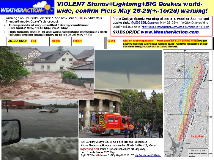
Great going Piers. Mag 7.1 New Zealand.
On 01 Sep 2016, Paddy (Aberdeen south, 130m elevation, sub) wrote:
9˚C overnight, 12˚ at 7.30, clear and cloudless start, not cold, light SWly breeze which increased through the day & warming up rapidly to 20˚ but by 11am the cloud started moving in from the W, it got cooler and we had a short downpour around 2pm, dry but cloudy thereafter, 14˚ at 9pm.
On 01 Sep 2016, Lorraine Lister (sub) NZ wrote:
7.1 quake of the north east coast of NZ early this morning http://www.nzherald.co.nz/nz/news/article.cfm?c_id=1&objectid=11702963. You did warn about a top R5 period Piers.
On 01 Sep 2016, Carl 45d Subscriber wrote:
Got Septembers forecast.August is now out the way but what was Piers forecast for August like one word BRILLIANT!!!!. If Piers can forecast this 100days ahead how come the BBC forecasts cannot forecast accurately just for this coming weekend all i have heard is the usual "THERE IS A GREAT DEAL OF UNCERTAINTY ABOUT THIS WEEKEND" They might as well just say we dont know and say goodnight
On 01 Sep 2016, Ron Greer wrote:
will there be a 30 day September option?
On 01 Sep 2016, Richard Brown from Hull, East Yorkshire wrote:
The gloves are off and the predictions have started!
Round 1
Met Office going for milder and wetter than average Autumn and milder than average winter.
On 01 Sep 2016, @CraigM350 Sub, Berks 51N wrote:
AndyL - Indeed it can:
"How far can lightning strike?
Almost all lightning will occur within 10 miles of its parent thunderstorm, but it CAN strike much farther than that. ***Lightning detection equipment has confirmed bolts striking almost 50 miles away.***
Can lightning strike me while I'm indoors?
YES! If a bolt strikes your house or a nearby power line, it CAN travel into your house through the plumbing or the electric wiring! If you are using any electrical appliances or plumbing fixtures (INCLUDING telephones and computers), and a storm is overhead, you are putting yourself at risk! FACT: About 4-5% of people struck by lightning are struck while talking on a corded telephone."
http://www.srh.noaa.gov/jetstream/lightning/lightning_faq.html#8
On 01 Sep 2016, Christine Gaskill wrote:
Thank you Gerry. I knew this was the place to get help. I really wanted to be able to discuss the article and was so disappointed when I just couldn't find it. Thank you.
On 31 Aug 2016, Paddy (Aberdeen south, 130m elevation, sub) wrote:
15˚C at 7.30, grey & dark start but brightening up sharply by 8am and although we had quite a stiff Wly breeze temps warmed up nicely to another 23˚ by early afternoon, not as many clouds as yesterday so we had longer spells of warmth. Cooling rather more rapidly towards evening and already down to 12˚ by 9.30pm. == DAVID - weve had neither drought nor heat up here but plenty cool in between the realtively short sunny/warm spells this summer, though this may not be the only reason either. Most of our bird cherries have lost the majority of their leaves more than a month ago, they are normally quite sturdy trees. I have noticed that almost every year there is one or other tree species that has something wrong with them.
On 31 Aug 2016, Maria ( Ireland sub ) wrote:
From last post we had a couple of nice days to end the school holidays, warm & sunny with a fair amount of cloud too, very mild on eve of 29th and breaking down with rain showers & a little cooler since. Showers this morning then clearing giving a dry afternoon a drop off in temp this evening n mostly cloudy. Noticed met have constantly changed their forecast this week and said a few days ago no threat from storm G.. Back to reality and alarm clocks tomorrow and thinking about logs!-)
On 31 Aug 2016, Gerry 45d Surrey-Kent border 223ft wrote:
Re- Land increase article. There is a post on WUWT covering this. The researchers expected to find the opposite of course. Nothing like approaching research with an open mind and in climate 'science' it is usually nothing like that. So we have another bunch surprised that AGW claims are suspect.
On 31 Aug 2016, Gerry 45d Surrey-Kent border 223ft wrote:
Christine - I bet somebody took that article down pretty quick. How dare they contradict the beliefs. However, once on the internet nothing is ever lost due to the wayback machine so search for it and look for a cache of the page. Well, glorious weather down here. Beautiful day for the show on Monday with a big crowd and a bit of sun exposure while sitting watching events while supping a pint or indeed two. And so it was yesterday too. A nice breeze keeping it from being too hot and allowing the house to keep cool. Temp drops off sharply come sundown though - result of the low solar energy coming in throughout the Summer? And today has started the same way and is continuing into the afternoon.
On 31 Aug 2016, @Piers_Corbyn (twitter) London, Chief forecaster wrote:
CITIZENS! Great insghtful Comms thank you all. In case you hadnt noticed TODAY 31AUG is the LAST DAY before all WeatherAction online prices go UP by about 50% to 70%. SO NOW IS THE TIME TO RESTOCK and extend your sub or join if you havnt yet and TELL A FRIEND TO DO IT! All best Piers
On 30 Aug 2016, Paddy (Aberdeen south, 130m elevation, sub) wrote:
14˚C at 7.30, bright & mild start, warming up rapidly but high cloud moving in after 10am, nevertheless got to 23˚, lovely summers day, autumn on hold for a minute, pretty stiff SSWly breeze, a mild 16˚ by 10pm.
On 30 Aug 2016, Christine Gaskill wrote:
Hi, this morning I saw an article, I think on the BBC News website of how, according to this study I've managed to find, the earth is gaining land not losing it to the seas. Now I can't find it, has anyone else saved it or seen it? Could you pass it on to me if you have please? http://www.nature.com/nclimate/journal/v6/n9/full/nclimate3111.html
On 30 Aug 2016, Andy L (Cambridge) wrote:
Any amateur meteorologists out there can help me please. I was watching the BBC weather show yesterday and during a piece on lightning storms, the presenter referred to a football match in Germany where three people unfortunately died due to a lightning strike. The presenter went on to say the the lightning bolt came from 25 miles away! I thought that electricity sought the most direct path to earth; am I missing something here?
On 30 Aug 2016, east side wrote:
Temperature in Ural dropped off a cliff 3-4 days ago.From 32-35C it fell to not much over 4C overnight.Autumn rain has come.
It hasn't rained properly for months.
Interesting fact.
The summer had such ideal conditions in Russia, Ukraine that Russia will become the largest exporter of grain in the world, overtaking the USA.
It's one of few bright performers in the current depressed Russian economy, brought on by illegal occupations of Crimea & Donbass area
This is the first time when it rivals the export performance of the period of the last Czars, (which if you may remember were not noted for driving around in any German made SUV & the crops were often harvested by hand.)
It is reckoned there is a vast acreage lying fallow in the ex USSR which could easily be put back into cereal production particularly in the vast siberian plains.
Interesting to see, by contrast, EU cereals production has been a cold damp year of poor to disastrous cereal production especially in France
On 30 Aug 2016, David wrote:
@Paddy @David
Early autumnal colouring is more often due to drought and/or heat rather than cooling (which obviously isn't the case this year.)
On 30 Aug 2016, Ron Greer wrote:
PADDY: yes the earliest leaf colouring I've seen here since 2010. I see Katya in Iceland is brewing up. If it's a biggie like 1918, we''ll see the effects soon enough.
On 29 Aug 2016, Paddy (Aberdeen south, 130m elevation, sub) wrote:
10˚C overnight, 13˚ at 7.30, misty but mild feeling start, bright morning but with regular clouds moving in on the fresh Sly breeze, brilliant sunny afternoon with a max temp of 20˚, lovely autumn day, short period of light rain around 7.30pm, 13˚ by 9pm. It is remarkable how many trees around the farm have turning leaves or are already half stripped bare, thats early.
On 28 Aug 2016, Paddy (Aberdeen south, 130m elevation, sub) wrote:
13˚C at 7.30, cloudy and still, brightening up to a reasonably sunny morning with a slight NEly breeze, beginning to cloud over by midday, quite a bit of rain further inland after 2pm, not as much here though, max temp 19˚, sunny end to the day with 13˚ again by 10pm.
On 28 Aug 2016, Gerry 45d Surrey-Kent border 223ft wrote:
Another evening of cool to aid sleeping. No chance of sleeping in too much as the clay shoot at the agricultural show kicks off early morning. Mainly cloudy but generally bright with the odd bit of sun and a couple of showers coming through. Strong breeze but humid. Big show day tomorrow so hoping for a good day for everyone. Ron - I don't think they are making it up. It is just that they are not able to model the weather properly a few days ahead. But somehow we are supposed to believe them 50 years down the line.
On 28 Aug 2016, Ron Greer wrote:
GFS now going for a roaster during the first week of September---you could not make this up----but THEY do.
On 27 Aug 2016, Paddy (Aberdeen south, 130m elevation, sub) wrote:
9˚C overnight, 11˚ at 7.30, sunny & fresh but soon warming up nicely even with the SEly breeze off the sea, max temp 20˚, lovely day with a real early autumn feel (I know Im repeating myself), 17˚ at 6pm & beginning to grey over, generally what happens when we get sea air.
On 27 Aug 2016, Maria ( Ireland sub ) wrote:
Yesterday although mostly cloudy allowed some nice sunshine to get through, felt very warm at times like today 20/21 deg. A cool light ese breeze also today.
On 27 Aug 2016, Gerry 45d Surrey-Kent border 223ft wrote:
Ian - Or not depending on which model you use as I think you are referring to the same storm I was below. Last night the heat went quicker and it was snuggle under the light duvet come bedtime at 2am - bliss. And so far this morning there is a good breeze stirring the trees that will make it more pleasant than the last couple of days. The leaves on a couple of fruit trees are starting to yellow already.
On 27 Aug 2016, Lorraine Lister (sub) NZ wrote:
A very rough night for Auckland NZ last night http://www.stuff.co.nz/national/83625455/Power-outages-road-closures-across-Auckland-due-to-high-winds
On 26 Aug 2016, Paddy (Aberdeen south, 130m elevation, sub) wrote:
13˚C at 7.30, grey start, not as cool as yesterday, sun coming out by 7, fine all day with a SW breeze, a few light showers around midday, max temp 21˚, sunny end to the day, mild evening, 11˚ at 10pm.
On 26 Aug 2016, Ian (Hertfordshire) wrote:
Ooh err! Blow me down! There is a big Tropical Storm Gaston brewing in the far West Atlantic and moving north. I wonder if the Jet Stream will capture it and sling it our way over to the UK? Will it pick up more heat as it moves over the warm ocean and spin up to hurricane force? Now by my reckoning it could arrive by late next week. The British summer could end with a bang and crash and loads of pomp!
On 26 Aug 2016, Gerry 45d Surrey/Kent border 223ft wrote:
Another hot night with barely a breath of wind to bring the cooler night air inside. As noted in the past when it was sunny and breezy it was not hot and now with little wind we have it hot. Thunderstorms around last night and there was some rain but the storms were to the east and west. Fresher this morning. Models - interesting post on WUWT showing GFS and ECM lack of agreement regarding a possible storm track for the US. One shows a storm but the other doesn't. Apparently they had the same problem for Katrina. And yet we are supposed to believe these models decades ahead when they can't agree on a few days hence. Hottest year? - not in Trondheim maybe as they have recorded coldest August day. Snow at Yellowstone closes a pass and this was from midday snow. Alaska - known to be snowy but there has been only a month between snow there as they got 8".
On 26 Aug 2016, Steve Devine wrote:
I appreciate we're still in the final few days of August, but I thought now would be a good opportunity to review the August 30d forecast. "Major heatwaves over all parts. Showers, hail & thunder mainly in North & West at times...searing heat in all parts from ~13th to month end". Well Piers with the exception of the autumnal storm which brought gales in places from 19th - 21st, it has indeed been a very warm/hot month here in SE England. Temps peaked at 33.8c in Gravesend on 24th and from 21st onwards the daytime temp exceeded the 22c average London August daytime maximum. "Dry, drought in south" - again spot on. Now subscribers wait with trepidation to see how September goes to plan. Another great forecast Piers. I appreciate the breakdown from 19th-21st was in your original forecast, but you pretty much covered all possibilities there. :-)
On 26 Aug 2016, Ron Greer wrote:
PADDY: Aye that autumnal feel is here and I see that the pro AGW Norwegian MO are saying that summer will be over this week and traditional seasonal weather will prevail. GFS all over the place on whether there will be a polar maritime outbreak at the end of this month/beginning of next or a week into next month. No such mucking about with WA.
On 25 Aug 2016, Paddy (Aberdeen south, 130m elevation, sub) wrote:
11˚C overnight, 13˚ at 7.30, much cooler and grey again, definite autumnal feel in the light NEly breeze, max temp 17˚, light rain in the evening, down to 13˚ by 10pm & foggy. Tomorrow will be warm and sunny again according to the MO.
On 25 Aug 2016, Maria ( Ireland sub ) wrote:
Mist across the fields this morning cleared quickly with a nice bright sunny morning, quite warm today for a time around 20 deg. cloud moved in during early evening and rain now tonight with a light breeze too..
On 25 Aug 2016, Gerry 45d Surrey/Kent border 223ft wrote:
Hotter yesterday than Tuesday and uncomfortably hot during the night. A lot of cloud had built up come home time and after dark there were a couple of spells of rain with big heavy drops. Warm again today but with more cloud and a light shower in London.
On 24 Aug 2016, Paddy (Aberdeen south, 130m elevation, sub) wrote:
14˚C at 7.30, dull & foggy but mild with a NEly breeze turning into the S in the afternoon, brightening up by 8am and turning into a gloriously sunny and warm/hot day with a max of 22˚, 14˚ again by 9pm. For tomorrow, MO says cloudy & cool with a max of 14˚. Over the last few days our weather has been seesawing wildly, brilliant sunshine alternating with cool foggy conditions. And always, as soon as the sun disappears it gets noticeably cooler, even on sunny days like today, just like last year.
On 24 Aug 2016, Maria ( Ireland sub ) wrote:
Some rain showers overnight on 22nd into the morning of 23rd then improving in the afternoon, around 3 a.m it dropped quite parky out. Sunshine and cloud today giving a nice enough warm dry day max 19 deg
On 24 Aug 2016, Gerry 45d Surrey/Kent border 223ft wrote:
Yesterday was the warmest for a while with the heat staying on into the evening. Fans on full to blow the hot air out of the house. And today is even warmer from the start. Heading off to the station there was no morning cool and some heat from the sun while standing on the platform. Netweather has the Jetstream coming up from the Azores and petering out come Friday so maybe one more day of heat?
On 24 Aug 2016, Steve Devine wrote:
M6.2 earthquake hits Amatrice and the surrounding areas in Central Italy during the night apparently...
On 24 Aug 2016, Lorraine Lister (sub) NZ wrote:
After very fine,calm weather in NZ during the R5 period we're having a wet week across the country during this quieter R period. Piers - would the build up to the big quake in Italy have started during the R5?
On 23 Aug 2016, Paddy (Aberdeen south, 130m elevation, sub) wrote:
14˚C at 7.30, overcast with a light NWly breeze, staying that way all day with fog added in the afternoon. Got to 18˚ nevertheless and we had just a bit of rain after 5pm, not lasting long. 14˚ by 9pm. So it wasnt as cool as the MO had predicted, always a bonus. Tomorrow it will be sunny and warm again, they say.
On 23 Aug 2016, Christine Gaskill wrote:
I note that Germany is to advise it's citizens to have 10 days food and water put by, causing many speculate as to why. I wonder if they know something about the coming winter?
On 23 Aug 2016, Ron Greer wrote:
Eastside is our international man of mystery, who says he's even on land?--he might be on a Russian submarine. GFS now backtracking on end of month cool snap for Scotland
On 23 Aug 2016, Mark Hall (Herts, UK) wrote:
East side
Are you enjoying a fishing trip on Karaginsky Island? Or hunting moose in Manitoba?
On 23 Aug 2016, east side wrote:
Currently at 58-59N.
(so that rules out pretty much all of UK)
'nuff said?
On 22 Aug 2016, Paddy (Aberdeen south, 130m elevation, sub) wrote:
13˚C at 7.30, very foggy start, Nly breeze, then suddenly cleared up around 10am and it got hotter & hotter to a staggering (for us, Eastside :)) 25˚ with a pleasant Sly breeze that gradually turned into the W, some puffy cumulus clouds as well as larger dark looking banks but it stayed dry and warm right to the end, long may it continue. According to MO well have a max of only 14˚ tomorrow, yikes. Still 16˚ at 9pm.
On 22 Aug 2016, Michael wrote:
Eastside,I would be grateful to know are you in UK or elsewhere?
Thank you in advance
On 22 Aug 2016, Gerry 45d Surrey-Kent border 223ft wrote:
Have I missed something but now we just have one solitary sunspot on the disc and I don't think the others rotated away. I haven't been looking for the last few days but I don't often recall seeing the spots just fade like that. I suppose they have to be facing some direction when they go. How long is the average life of a particular sunspot?
On 22 Aug 2016, Gerry 45d Surrey-Kent border 223ft wrote:
Rain overnight on Thursday and then a series of showers during Friday, some heavy, but getting less as the day went on. A heavy burst of rain during Saturday morning caused a delay in qualifying at Brands Hatch and somebody a bent bike as they got caught out. With the strong wind, it dried fairly quickly but there were another couple of rain showers before clearing during the afternoon. Some showers overnight but then Sunday was dry and windy with the sun coming out during the afternoon and making it quite warm. Cloud built up during the evening and there were showers overnight. Grey start but the sun came out during the morning and it has been very pleasant and getting quite warm. In this 'hottest year evah' Twente in the Netherlands has had the first frost on record for 19 Aug. And also from iceagenow some record low highs in the US by some startling amounts such as high 20s and low 30sF not just the odd degree or two. Still not seeing this hottest bit in reality.
On 22 Aug 2016, Ron Greer wrote:
EASTSIDE: Well, you've set it out quite plainly and I hope you get to say 'I told you so' Quite autumnal here in Scotland and some signs earliest for years. I see GFS are predicting quite a sharp northern blast at the end of the month and wonder if we'll get snow above 1000metres
On 22 Aug 2016, Maria ( Ireland sub ) wrote:
Showers on n off yesterday max 18 deg & becoming quite mild overnight. An improvement this morning quickly turning into a nice sunny day with some big clouds here n there, max 19 deg more cloud moving on in with a light breeze now just after 5pm
On 22 Aug 2016, Mark Hall (Herts, UK) wrote:
Still waiting on Dansgaard-Oesger speculation.
Read in the paper the other day that smirking prof. Brian Cox says you cannot argue against human activity causing an increase in average global temperature. So a deficient theory, data that is tortured into conformity and confusing a weak correlation with criteria for causation are sacrosanct, are they? Makes you suspicious of his supposed field of expertise.
Then again bozos like him at CERN are still oblivious to what is staring them in the face: that gravity is an electro-magnetic force.
Those floods in China all summer look set to knock out a sizeable chunk of food production. This coming La Nina is looking like a rough ride.
On 21 Aug 2016, Paddy (Aberdeen south, 130m elevation, sub) wrote:
14˚C at 7.30, sun breaking through clouds, wind changed into the NW but not feeling cold as it was returning warm air. Whenever the sun was out it got really warm, max temp 21˚, and we had a lovely sunny end to the day, 15˚ at 9.30. According to MO it will be even warmer tomorrow.
On 21 Aug 2016, east side wrote:
Not sure what people are calling "heatwaves".
Is this anything over 25C in the UK?
Here we've proper summer heat.Daytime temps of over 30-32C every day for a further week.
This was the summer we didn't have in Ural Russia last year.
To get a perspective on this,-
France has a failed harvest with something like 60% down on yield thanks to the extremely wet spring & early summer.
The french farmers are requesting moratoria on bank interest payments..
I note how Baltic states farmers appear to be committing suicide by buying the latest most expensive equipment on bank loans, on the bases of ? "global warming"?
This year marks a strong change to generally COLDER climate (NOT hotter at all!).
It is normal after the expiry of El NINO influences of the last 5 yrs.
El Nina continues to make for what shapes up to look like unusually cold winters, almost non existent sun spots, higher Cosmic ray activity (6% up), much higher rain/snowfall & bitter COLD, & no energy policy to match!
On 20 Aug 2016, Paddy (Aberdeen south, 130m elevation, sub) wrote:
14˚C at 7.30, still grey & misty & damp from copious overnight rain, winds SEly 7 gradually turning more Ely, quite a bit of sunshine breaking through after midday, max temp 19˚, some heavy rain early evening but altogether a milder day than yesterday, 14˚ again by 9pm. == Out on a walk this afternoon, picking lots of chanterelles, we noticed just how autumnal everything looks, feels & smells, agree with Maria & everyone else on that, we seem to have more or less skipped summer & gone from spring into autumn.
On 20 Aug 2016, Maria ( Ireland sub ) wrote:
A brief calm start yesterday with a few sunny spells before clouding over then rain and wind moved in after lunch, felt like October not August!-) Still blustery this morning and still raining. 13 deg at 10.22 a.m
On 19 Aug 2016, Paddy (Aberdeen south, 130m elevation, sub) wrote:
13˚C at 7.30, grey & cool again with fog descending to quite low levels through the day, our hill was certainly well shrouded for most of the day, SSEly breeze going all day and bringing rain from the LP system currently over Ireland from about 6pm onwards, max temp 16˚ but feeling cold in the wind. Somewhat milder by late evening, 14˚ at 9.30pm.
On 19 Aug 2016, Steve Devine wrote:
FAO Piers : Looks like you maybe should have stuck with the previous SLAT suggestion that there would be a 'catastrophic breakdown' of the hot conditions 18th - 22nd August after all sadly. Still, the heat returns with a vengeance next week. The only question is, will the Atlantic return before the month is out, or will the SE'ly influx of heat continue?
On 19 Aug 2016, Steve Devine wrote:
GFS Model Watch : As the ECMWF overstated this week's maximum temperatures I thought I would switch to the even less reliable GFS model. This weekend sees an autumnal 'Dartboard Low' attack the UK with gales in exposed western coastal areas. Eventually a cell of High Pressure over a baking hot France encroaches over our shores by Tuesday heralding a change as we import dry, hot continental air. By Wednesday temperatures are forecast to clip 30c by day, 19 or 20c by night (which I personally find abhorrent sleeping conditions). Thunderstorms in SW areas eventually spread to all areas by Friday as a cooler SW'ly flow takes over and into the Bank Holiday Weekend which looks like a mixed bag, but generally drier in SE England.
On 18 Aug 2016, Paddy (Aberdeen south, 130m elevation, sub) wrote:
14˚C at 7.30, foggy all day with occasional drizzle in the morning, lifting somewhat in the afternoon, though not enough to let the sun through, SSEly breeze and a max temp of 17˚ which felt rather cooler than that in the wind, 14˚ again by 9.30pm. So thats it for our corner of the world, it seems, the last three days constituted our summer.
On 18 Aug 2016, Maria ( Ireland sub ) wrote:
A brighter start to today and some nice sunshine for a time before clouding back over, dry all day and humid for a while. Max 20 deg less humid this eve. mild with a light sse breeze. Willow trees & silver birch joining the chestnut tree In changing colour already, clematis and sweet peas finishing too..
On 18 Aug 2016, Steve Devine wrote:
Very quiet in here today. Time to do another ECMWF model outlook I think. The model has us experiencing unseasonably windy conditions over the forthcoming weekend. Several bands of blustery showers sweeping over the UK until something extremely odd happens early next week. The dartboard low off the coast of Ireland suddenly regresses back out into the Atlantic, opening the floodgates to another Spanish plume from the south as High Pressure makes it's presence felt over a scorching France. The HP cell then moves to the north of the UK allowing a warm/very warm SE'ly flow to return The chart stops on Sunday 28th with the UK still basking in S/SW;ly winds. All subject to change. Let us not forget that the same models had the UK enduring 32c heat a week out, only for it to drop all the way down to 23c (yesterday).
On 17 Aug 2016, Paddy (Aberdeen south, 130m elevation, sub) wrote:
14˚C at 7.30, cloud blanket at first but lifting by 9am and turning into the most brilliant of the last three days with wall to wall blue sky. Usual Sly sea breeze strengthening throughout the day, so max temp was only 20˚, no complaints though. 14˚ at 10pm.
On 17 Aug 2016, Gerry 45d Surrey-Kent border 223ft wrote:
Stepping out from the air conditioned building it was noticeably a few degrees warmer today. Staying warmer into the evening as I went picking plums. Sun was setting into cloud so not so good but a lovely moon was visible in the east. Will need the fans on to cool the bedroom before sleep time. The grass has barely grown the last week or so. The grazed fields are looking dusty here too.
On 17 Aug 2016, Maria ( Ireland sub ) wrote:
Enjoyed our 2nd day of warm sunny weather yesterday, back to grey and rain today max 17 deg and a little humid. Not really a heatwave here but a wee break from the rain was good :)
On 17 Aug 2016, Maria 45day sub somerset wrote:
29 here in the shade at 15.30. I have had to close all solar shading for a few days as it is far too hot for me. My mid season apples are ready to start picking. Harvesting is all done, just a couple of bale trailers on the roads, farmers must be very happy here, arable farmers that is, grass is yellowing in fields and ground is very hard, dairy farmers with outdoor herds are having to change fields regularly. Humidity out is 48. Indoors it is 68 and temperature inside is 22. Meto weather changes by the hour, couln`t rely on it at all. Looking forward to a few days time
On 17 Aug 2016, Ian (Hertfordshire) wrote:
Well it looks like the UK weather will switch after the Full Moon on moring of the 18th August. There is already a nasty Low in the Baltic and another is brewing in the Atlantic and looks like it's heading our way for the weekend. Farmers will be well pleased they listened to Piers sound weather advice and they can relax at the weekend to celebrate their harvest!
On 16 Aug 2016, Paddy (Aberdeen south, 130m elevation, sub) wrote:
14˚C at 7.30, another brilliant sunny day with much less cloud than yesterday, the obligatory sea breeze starting up by 10am and gaining in strength through the day, max temp 22˚, down to 12˚ by 10.30pm. == Big KUDOS to PIERS for the forecast this month: we waited until yesterday and toay to replace both our big tunnel covers 13-17 Aug Heatwave, this is always a bit of a stressful undertaking as said sea breeze can reach quite some strength, especially in HP weather, so the fact that we had brilliant sunshine on both days made all the difference, plastic stretches much more easily. Although it hasnt been a heatwave as such it certainly was the opportunity that we had been hoping for.
On 16 Aug 2016, Gerry 45d Surrey/Kent border 223ft wrote:
The weather is pleasant as it is not too hot during the day and any heat quickly fades. I used two 18" fans last night to blast the air through my bedroom last night to bring the temp down from 76F to 62F in a short space of time. I agree with the comments from Ian. Haymaking in full swing to take advantage of the dry weather down my way. Heavy dew that traces of are still on the windscreen come 8am and quite cool going to the station. Looking at Netweather Jetstream page shows it not reaching down to Spain for a few days yet so I presume it hasn't behaved as forecast so far?
On 16 Aug 2016, Maria ( Ireland sub ) wrote:
Misty cool start yesterday morning followed by mostly clear blue sky and sunshine temp taking a slow rise to 20 deg nice afternoon despite the breeze and a cooler evening, looks like a second day of sunshine on the cards..
On 16 Aug 2016, Ian (Hertfordshire) wrote:
What happened to the heatwave and Spanish plume promised for the UK? The last 2 mornings it has been very Autumnal with a hard dew and damp cool air until 9am when the sun gets higher in the sky.
Farmers are busy making hay - the harvest is early and they must be anticipating a breakdown of the sunny weather very soon! I must have blinked and missed the UK heatwave!
On 16 Aug 2016, stephen parker wrote:
So no heatwave for us then, just typical august weather.Several long range subscription forecasters called this wrong from only a week out.
On 15 Aug 2016, Paddy (Aberdeen south, 130m elevation, sub) wrote:
9˚C overnight, 11˚ at 7.30, still, clear blue and sunny start to the day and pretty much remaing so all day, except for the pretty beefy Sly sea breeze starting up around 10am, typical for when we have HP weather. Max temp 22˚ but feeling cold in the wind out of the sun, again a strange mixture of hot and cold. 11˚ at 10.30pm.
On 15 Aug 2016, Gerry 45d Surrey/Kent border 223ft wrote:
Come just after sunset I was still outside in t-shirt and shorts and had I not been going in for the evening I would have needed more clothing. Temp had dropped to 64F at this time. A clear night with a mist over the fields and then a blue sky and sun in the morning. Some cloud developing but a nice day so far.
On 15 Aug 2016, Steve Devine wrote:
ECMWF model final update (unless you guys want this to be a permanent feature of course!?); Slack easterly flow on Wednesday as High Pressure centres itself over the far north of Norway. Out of nowhere, a dartboard low pressure cell is knocking on our SW shores by Friday, heralding a pattern change to unseasonable wet and windy weather for the weekend. Unsettled next week, then a new High Pressure cell bodes well for the Bank Holiday weekend/end of August. Wild swings indeed Piers!
On 14 Aug 2016, Paddy (Aberdeen south, 130m elevation, sub) wrote:
Been away for a couple of days at Dinnet in the Dee Valley about 30 miles west of here. Although Friday started dry and mild, it was pretty cloudy, max temp 21˚, some light rain end afternoon. Saturday was a sunny day with a strong SWly breeze and some cloud but got to around 21˚ again. Today mostly cloudy until mid afternoon when it was sunny & got to 21˚, bright end to the day, 12˚ at 10pm.
On 14 Aug 2016, Gerry 45d Surrey-Kent border 223ft wrote:
Friday early Friday evening was warm and grateful for the air con in the Boom Boom Club - it used to be like a furnace before even for us punters. But coming out it was best described as chilly. No need quite of heating on the way home but air vents closed. Fair amount of cloud during Saturday before it cleared into the late afternoon. Bright with sunny spells so far today and at 2pm the gauge reads 73F - not hottest ever for an August day but was does data matter. The Committee for Climate Change set up under the Climate Change Act and noted for not including anyone who knows anything about climate has just released another wad of drivel and dubious statistics. Paul Homewood has verified one claim - increasing number of hot days since the 60s - but interestingly he noted that they have decreased since the 70s!! H/T to Not a lot of people know that and Booker who picked up on it for today's column.
On 14 Aug 2016, Steve Devine wrote:
ECMWF Model Update: Peak of warm spell on Wednesday then shallow low pressure promises 20mm of rain in SE England for Thursday. Next weekend is polar opposite of this one. Sinking Jet Stream opens floodgates to a unseasonably powerful storm which promises spectacular rainfall if it happens. I'm grateful that the record heat was avoided, but more grateful our house renovations occured during warm and bone dry conditions.
On 14 Aug 2016, Maria ( Ireland sub ) wrote:
Last few days mostly overcast with some sunny spells and light isolated showers not really much higher than 17/18 deg as yet. Ron our chestnut tree is already changing colour here, an early autumn look on the cards this year..
On 14 Aug 2016, Ron Greer wrote:
So a warm period, not a heatwave and at least the Mobeeb are admitting their predictions were an overestimate. Up here the general autumnal feel is augmented by the earliest leaf colouring I've seen on my 'marker trees' ( a maple at Killiecrankie and a rowan at Faskally)
On 12 Aug 2016, Maria 45day sub somerset wrote:
11.30 am wind wind from west 5 mph. Humidity 70. Temperature in shade already 22. Comfrey looks as though it has had enough of summer and has some of that autumnal mildew. Apples are large on all my trees and look almost ready. Tomato leaves outdoors are dsesicating and all fruits are ripening fast. Runners, courgettes and squash are all producing furiously. Harvest is almost done, will be one big celebration supper this year. I dislike intense heat, especially prolonged so am almost ready to get into my cool cave
On 12 Aug 2016, Steve Devine wrote:
ECMWF Chart Update - UK basking in heat on Tuesday with light SE/E'ly flow. By late Wednesday/early Thursday a (weaker than previously thought!) Low Pressure cell crosses the country swinging the winds back to an Atlantic component. An unsettled second half of next week, then a new HP cell from the Azores bubbles up, crosses us then parks itself (switching to GFS model now) over Norway giving us a very warm easterly flow for the last week of August. So if next week's heatwave is considered a flash in the pan, maybe the one at month end will not disappoint. Still, those charts are 'Fantasy Island' land at that range of course. Next update on Monday.
On 11 Aug 2016, Paddy (Aberdeen south, 130m elevation, sub) wrote:
12˚C at 7.30, feeling much milder, light rain going on to midday and followed by a few hours of sun breaking through the clouds and temps rising effortlessly to 21˚ max, rain again by 6pm, still 17˚ by 8pm. The contrast to yesterdays reports of frost couldnt be greater, feels like the advance party of the Spanish Plume.
On 11 Aug 2016, Maria ( Ireland sub ) wrote:
Last couple of days have been breezy but a tiny bit milder by day not as chilly last night as previous evenings outside and some sunny spells mixed in with the overcast sky. Met here yesterday mentioned for the first time a warmer weekend and early next week ahead with a breakdown Wednesday, thank crunchie for Piers heads up as really handy for making plans ;)
On 11 Aug 2016, Gerry 45d Surrey/Kent border 223ft wrote:
Re Polarocean - somebody posted a helpful comment that there was an icebreaker nearby and a tanker so they should follow them. In prime Guardian 'Comment macht frei' style it was removed. No sense of humour these greenies. Delingpole has highlighted the slaughter of the bats by the windmills and an Oxford report suggesting that if the number of windmills increases as planned they will run out of bats to kill. Bats have so much protection because they live long and produce a small number of young, rendering them vulnerable to the loss of 3 million or more per year.
On 11 Aug 2016, @Piers_Corbyn (twitter) London, Chief forecaster wrote:
GREAT WELL INFORMED COMMS CITIZENS. Steve all yes watch the shifts in weather and medium range models carefully. We are very interested in the potential breakdown later next week which was very ferocious in SLAT12c(s) but less or stalled more or less mostly under SLAT13 so interesting to see if it is fllly stalled or temporarilly stalled compared to medium range models.
MEANWHILE since getting the heatwave from 100d ahead is a big success please, readers, pass on this information to any potential subscribers and remind them new subs get a FREE month. So for new subs:- Aug+Sept is charged for 1m; 6m gets 7 (charge5); 12m gets 13 (charge 9). Thanks
On 11 Aug 2016, Steve Devine wrote:
Media coverage for next week's hot spell all over the show. Daily Star front page has "Two week heatwave inbound" all over it, yet the computer models are pipping for heat only last Tuesday and Wednesday. I think I'll stick with WeatherAction, far more reliable than some rabid foaming of the mouth from James Madden. Even a clock is right twice a day. ;-)
On 11 Aug 2016, C View wrote:
Seems like the Arctic sailors are having a tough time finding a route through the ice (that all melted some years ago, allegedly) read about it here http://polarocean.co.uk/ . Very interesting comment @Craig M regarding snow on Ben Nevis given that there was a mild start to winter and snow didn't start accumulating until well in to January and snow depths generally in the Scottish hills were down on previous years and then May in Scotland was much warmer than last year giving earlier melting. So I guess this is quite a strong indicator of lower baseline temps.
On 11 Aug 2016, Steve Devine wrote:
Morning all! Another ECMWF chart update for you. The bubble of High Pressure that's currently out to our west will be directly over us by Sunday evening. By Monday we start importing the 'Spanish Plume' sending temperatures past the 30c mark by Tuesday and Wednesday. By Thursday an active Low Pressure cell centred over the Midland brings what I would imagine to be torrential downpours accompanied by thunderstorms as the winds return to a SW/W'ly component. Interesting (although probably unreliable) our to next weekend as another High Pressure cell reloads just to our south rejuvenating our chances of more warmth from the near continent.
On 10 Aug 2016, Paddy (Aberdeen south, 130m elevation, sub) wrote:
5˚C overnight, 7˚ at 7.30, however, I heard from an acquaintance that they had seen frost on the grass at the local academy at 6am! Thats very early, usually the first (light) frost comes at the end of August - but its chicken feed compared to Carrbridge, RON, blimey! Clear, sunny morning and even with the light NWly breeze it got to 17˚ max. However, after midday cloud began moving in from the west and it turned cold in the strong SWly wind, light rain from 4pm onwards, still going now at 10pm in 12˚.
On 10 Aug 2016, Gerry 45d Surrey/Kent border 223ft wrote:
Replicating Monday, a bank of cloud came from the north-east to bring a very brief rain shower before clearing away later in the evening. Today it was cloudy to start but has now cleared after lunch. Temps staying pleasant and warm rather than hot.
On 10 Aug 2016, Ron Greer wrote:
PADDY: spot on as there was a -3C frost at Carrbridge with frozen windscreens on cars. There's actually a photo of that on Facebook with date and temperature finger-written on the frozen windscreen . I replied that all this was nonsense as all the ice melted in the summer of 2013! With one of the stormiest summer days ever recorded in Scotland just 48 hrs ago, it's been quite a week. Looks like the Spanish Plume is going to last long enough to prove Piers correct, but for those of us who are cold-adapted not long enough to be horrendous.
On 09 Aug 2016, Paddy (Aberdeen south, 130m elevation, sub) wrote:
8˚C overnight, 10˚ at 7.30, feeling distinctly chilly under a brightening sky, still breezy from the NW and staying that way all day, good long spells of sunshine but the minute there was any cloud it got much cooler immediately, no heat reserve, just like last year. Max temp 17˚ in the sunniers spells, down to 8˚ again by 10pm under a clear sky. Id almost bet therell be a frost in the Highlands tonight.
On 09 Aug 2016, @CraigM350, Sub 51N wrote:
Stunning!
http://weatheraction.wordpress.com/2016/08/09/astonishing-snow-depth-on-north-face-of-ben-nevis/
On 09 Aug 2016, Maria ( Ireland sub ) wrote:
The last few days have been a mix of cool and fresh morning and night with a warmer bit in the middle, some windy spells too and big cumulus clouds with showers at times and sunny spells also, like Piers has forecasted a real flip flop of weather that could have you caught out changing on a dime. Some high cloud today with a breezy wind and spells of sunshine around 17 deg here just after lunch..
On 09 Aug 2016, Gerry 45d Surrey/Kent border 223ft wrote:
Rain! Yes, on the journey home in defiance of the juvenile RMT strike, there was increasing cloud. Off to a quiz evening and there appeared to be some spots on the windscreen. Leaving there had been some rain and on the way home there were some spells of rain. Cool evening. Fresh again this morning with a cloudless sky but cloud bubbling during the day. Paddy - it is fun to see them stumble. I enjoyed the moment on live late night TV where one forecaster admitted their models were of no use with a meridianal jet stream. Assessment seems to be that 2016 will not exceed 1998 in the satellite records.
On 09 Aug 2016, Ron Greer wrote:
STEVE: not a lover of great heat myself, but you've got to hand it to Piers for seeing it when standard models failed to see. It's a real hoot listening to John Hammond admitting in the long range forecast on the Beeb this morning, that it was unforeseen ( by them)--priceless.
On 09 Aug 2016, Steve Devine wrote:
ECMWF model watch... High Pressure sits slap bang over the UK on Sunday. Temperatures still tolerable by then (25-27c in London for example). But by Tuesday we have a blast from North Africa. Much hype on social media quoting ''36c" and "over 100f possible" but time will tell. One thing is for sure - we know who to thank for seeing this coming a long way off. I personally loathe such weather. Not being grumpy, but I'm a long-suffering commuter with asthma and high blood pressure. Thankfully, winds are back into a cooler NW/W'ly by Thursday...hopefully.
On 08 Aug 2016, Paddy (Aberdeen south, 130m elevation, sub) wrote:
12˚C at 7.30, cold NWly wind blowing hard under an overcast sky to begin with, brightening up though and the wind increasing in strength until about midday after which the strong gusts became more sporadic. Lots of leaves lying about, more autumn, and anything that wasnt tied up properly fell over. Got to 19˚ nevertheless and we had a few light showers, blue sky in between though. Chilly 9˚ at 10pm & feels like wanting to go down even further, wind now only very slight.
On 08 Aug 2016, Gerry 45d Surrey/Kent border 223ft wrote:
Sunny day for the City. Fresh this morning in keeping with our observations for mornings and evenings. It was breezy yesterday but I would have said it was cooling rather than blowtorch. Working out until dusk it was pleasant. I have some mini-plum trees that are now about ripe as one fruit came off in my hand and was very nice. These took me by surprise last year as I didn't know they were there. My medlar that I only bought this year and was in a soil filled basket on my patio for a while has an amazing 10 fruit. The great passage trek has gone a bit quiet but the big NW passage cruise liner should be under way this month. Meanwhile 2 British climbers have frozen to death on the Matterhorn when a storm blew up. The climbers phoned for rescue during the night but couldn't be reached until daylight. They were found dressed in light clothing with nothing to protect against freezing temperatures. Did they fall for the global warming myth?
On 08 Aug 2016, Ole Jensen wrote:
Geoff. You can follow the ship of fool no. 2 here :
http://polarocean.co.uk/
On 07 Aug 2016, Paddy (Aberdeen south, 130m elevation, sub) wrote:
13˚C at 7.30, sunny if windy from the SW, strengthening through the day but still got to 21˚. On our way inland we did see combining of winter barley going on, so we are kind of on track growth-wise. Also picked lots of blueberries with our special picking comb, about 2kgs in half an hour. Today was a real summers day even though it felt distinctly like the very end of summer, not to say autumnal. Confirmed by 12˚ at 9pm with the wind still fresh.
On 07 Aug 2016, Geoff wrote:
anyone got any gen on whereabouts of the Great NE and NW passage voyage around the Arctic they can share?
On 07 Aug 2016, Steve Devine wrote:
Just back from a trip to West Mersea in Essex. Temp was 28c with a blowtorch SW'ly breeze. Am personally looking forward to the impending cooldown and single digit temps tmrw night. ECMWF going for heatwave in S England next Saturday with HP to south and LP to the north.
On 07 Aug 2016, Maria 45day sub somerset wrote:
my village is sheltered between two sets of hills. I can hear the grain dryers working at the moment, 16.05. Several fields were cut yesterday, morning was more humid until 11 but has since been mega sunny with a wind of 10 mph and I can now hear trailers being rushed to the dryers. Sounds as though the local arable farmers have hit lucky this year. Big cumulus clouds but whatever they are holding is being dropped elsewhere. Picked the very last of my 6 blackcurrant bushes this morning, big juicy berries. Hedges were cut as the lanes were getting very narrow, really big growth early this year. Like summer has been squashed into a short and very intense period
On 07 Aug 2016, @Piers_Corbyn (twitter) London, Chief forecaster wrote:
GREAT COMMS ALL THANKS. HAVE YOU NOTICED AMAZING TRIAL OFFER TODAY - ends on MONDAY evening. Offering "TheLOT" at equivalent of 6 for 1 if you buy 12months, and still amazing for 1m, 6m. ALL existing subs with overlaps on a TheLot sub get extended so if you go for this or any of the other offers you extend any subs you have at a really low price. Pass it on. Thanks Piers
On 07 Aug 2016, Gerry Surrey/Kent border 223ft 45d wrote:
Somerset heat wave then? Another pleasant day with lots of sun but a strong breeze to keep it from getting hot. Seems like we were saying the same thing last year. And also like last year, in agreement with Maria, not warm in the mornings or lingering into the evenings. Overcast today with the same breeze. 1pm and it is 76F. Rare snow for Lesotho and plenty to keep skiers and snowboarders happy in NZ.
On 06 Aug 2016, Maria ( Ireland sub ) wrote:
Yesterday was fairly muggy in the day temp around 19/20 deg and again some sunny spells amidst the cloud, temp dropped off in the evening though. Today Saturday was similar a few sunny spells and warmish around 20 deg wind starting to get a bit breezy this evening.
On 06 Aug 2016, Paddy (Aberdeen south, 130m elevation, sub) wrote:
Maria Somerset, I meant you with my comment rather than Maria Ireland! Note to self: pay more attention!
On 06 Aug 2016, Paddy (Aberdeen south, 130m elevation, sub) wrote:
9˚C overnight, 10˚ at 7.30 under a blue sky and sunny start, warming up quickly to 21˚ max with a fresh SWly breeze that intensified during the afternoon. Clouding over in the afternoon with showers starting around 5pm, some of them very heavy, but the bulk of rain from the LP was further N & W. 14˚ at 9pm, definite autumnal feel in the air, amazing to hear of combining in Ireland, Maria. This is probably the normal time of year for you but it couldnt be more different from our parts in terms of weather, though barley fields are beginning to turn yellow as they usually do in August.
On 06 Aug 2016, Maria 45day sub somerset wrote:
4.20 pm and temperature is 28.7 in the shade. The combines are working full pelt and it is manic here, harvesting is going well. I was very glad of the rain a few days ago and all butts and rain water harvester are full. Soil is moist and air is hot with mega sun, so allotment is cropping like wildfire, Humidity out is 56. At the same time, it feels autumnal morning and evening. Stove serviced, flue and gutters cleaned and am ready for this weather to turn on a sixpence
On 06 Aug 2016, Gerry Surrey/Kent border 223ft 45d wrote:
Leading on from that, Paddy noted that he has seen a change since 2006. Those who spend a lot of time outdoors are more in sync with our weather as others here have noted. And yet we are going to be told that this year is the warmest ever. Iceagenow has posted that NZ could see the coldest temps in a century, added to the other southern hemisphere reports are we right to think that the once revered agencies are lying? In the internet age we - if inclined and having the time - can source the raw data and see how it contradicts their claims. You can also read articles on reasons why they are getting the wrong results - although supporting their belief. Temperature gridding for example. Surprised that there is nothing from the whole of Bolivia included? And the lack of actual recording stations in the Arctic where we hear claims of warming? Then there is UHI. Increasing night time minimums that push up the average temp while the maximum stays the same. Time will tell, and maybe soon.
On 06 Aug 2016, Gerry Surrey/Kent border 223ft 45d wrote:
Bit of a cross comment site post. Richard North today highlights one of the Vote Leave ignorati, Daniel Hannan, being allowed to spout off in The Spectator that it is easy to leave the EU - just repeal the European Communities Act 1972. He notes a comment posted that says that what Hannan says is rubbish, he must know it is rubbish, and The Spectator - claiming to be at the leading edge of political comment - must know it is rubbish so why was it printed? Richard writes an interesting post about the diminishing knowledge of the Elite and the growing knowledge of the public thanks to the internet. Before you would doff your cap to a member of the Elite in the belief that they were more intelligent, better educated and knew more than you did. While points 1 and 2 may still hold, point 3 certainly doesn't. The referendum campaign and the current aftermath shows that. And this applies to our topic, climate science where a mining engineer trashed the famed Hockey Stick.
On 06 Aug 2016, Russ NE Derbyshire wrote:
Re: future low food production. Some links on 'Ice Age Now' over the past few weeks have been showing exactly this. Forget cold wet summers being damaging to crops because events lasting just a few days have wiped out crops in France, Argentina and many other countries. Huge/large/giant/big hail is a repeating factor destroying not just crops but fruit trees, vehicles, homes and more. Floods and unusual snowfall are to blame for crop losses across larger areas. If this is just caused by sudden slight dips in temperature, imagine whats coming when the temp falls by several degrees, average, across the globe, and the dips become deeper and longer....
On 06 Aug 2016, Lorraine Lister (sub) NZ wrote:
More heavy snow in NZ this time in the North Island http://www.stuff.co.nz/national/82888321/live-bitter-cold-snap-hits-bringing-snow-black-ice
On 05 Aug 2016, Paddy (Aberdeen south, 130m elevation, sub) wrote:
10˚C overnight, 12˚ at 7.30, grey with a glimpse of sun, cool, max temp 17˚, wind Wly to start with, then turning into the SW, some sun by end of afternoon but heavy showers after 8pm and wind turning into the NW. == Yes, food production might suddenly become problematic. For various reasons we were late this year getting some of our veggies into the ground, which we now regret as we missed the relative heat in May and early June. I am now looking into setting up a good propagation system for early starting of seedlings so that we can hit the ground running and maximise every ounce of heat & light we can get. Up to 2006 we could be casual with the growing season, thereafter its been going downhill, ie. colder and wetter summers which now feel like the future.
On 05 Aug 2016, Ron Greer wrote:
Beeb still going for cool NW winds next week with big high pressure over Atlantic ( just as well it is not February Paddy and Gerry). Norwegian Weather Service report unusually autumnal weather in the Vestlandet counties.
On 05 Aug 2016, Gerry 45d Surrey/Kent border 223ft wrote:
Hmm - February in August. Paddy that rings a bell as following the low temp high humidity evening that was very pleasant, Wednesday brought warmer temp but a cold westerly wind such that it was cold to in a t-shirt at 7pm. I thought it seemed more like Spring or Autumn than August. Yesterday was warm with some cloud. Arriving home there had been a bit of rain. Nice again today without being hot. Hope it stays clear to see Jupiter next to the moon this evening. Iceagenow reporting the worst grain harvest in a decade in France, and reduced yields likely in Germany, Poland and the UK due to the weather. MIA = less food. British Columbia reports coldest August day since 1930s - where is all this warming?
On 05 Aug 2016, Lorraine Lister (sub) NZ wrote:
More on our winter weather http://www.stuff.co.nz/national/82842114/live-snow-hits-dunedin-canterbury-severe-weather-warnings-in-place. Winter temperatures have come later this year. Last year's very cold temps were in early to mid July. However, August can be very cold in NZ with heavy snow in the south and this often brings problems for farmers with lambing.
On 04 Aug 2016, Maria ( Ireland sub ) wrote:
Sunny start then the return of the familiar overcast sky we get so often but a few sunny spells and some high cloud giving us a sneaky bit of blue sky in small places as the day went on, a bit warmer today without the wind & some very light short showers here n there, max 18 deg mostly cloudy and 14 now at 11pm
On 04 Aug 2016, Paddy (Aberdeen south, 130m elevation, sub) wrote:
12˚C at 7.30, overcast and cool in the NWly breeze which kept going all day, sometimes at a fair old clip. Max temp 17˚, no sun at all; if this was February we would call it a mild day but it appears to be August. Som light rain early evening, otherwise quite dry, 12˚ again at 10pm.
On 04 Aug 2016, Ron Greer wrote:
beeb going for increasing amplitude in Jetstream and cool NW winds for next week, but very tentatively.
On 04 Aug 2016, Steve Devine wrote:
ECMWF Model Watch Day 2 : Sat 13th August now basking in warm sunshine as the High Pressure cell that was to our west has instead slipped slap bang over the top of the UK. Interesting...
On 03 Aug 2016, Paddy (Aberdeen south, 130m elevation, sub) wrote:
15˚C at 7.30, feeling much milder, misty and sunny start with cloud moving in and very still. Quite sunny and humid most of the morning, temps rising nicely to 23˚ but the Sly wind was fresh, even cold in the afternoon, not too surprising as it was returning polar air which brought more cloud and a few showers. 14K at 10pm.
On 03 Aug 2016, Gerry 45d Surrey/Kent border 223ft wrote:
Forecasts eh? Try Accuweather on Sunday for Monday and Tuesday. I was supposed to get one shower around noon Monday and then a thunderstorm Tues afternoon. There was a shower on Monday but it was really a spell of rain that started an on and off pattern for the rest of the afternoon before really setting in during the evening and bringing a whole inch of rain! Yesterday was mostly overcast and no thunderstorm. What was noticeable was the effect of humidity. At 7pm yesterday it was 64F. Not within the warm part of the temp range but I was fine in a t-shirt. Cloud has cleared during the morning and it is bright now in town.
On 03 Aug 2016, Ron Greer wrote:
Beeb equivocating now, but also going for cooler weather as is the Norwegian MO.
On 03 Aug 2016, Ron Greer wrote:
STEVE: this largely concurs with GFS which is not predicting severe heat mid month over the UK, though hot continental air is going to pervade over Scandinavia.
On 03 Aug 2016, Steve Devine wrote:
I thought it would be prudent to do a model watch as we enter deeper into what could be a very interesting month of August. (For this task, I shall be referring to the ECWMF rather than GFS model which tends to be more reliable.) So, if we push it out as far as it currently goes - Sat August 13th sees High Pressure to the west of the UK and Low Pressure to the east. This results in polar / northerly winds sweeping down the nation. Next update tomorrow...
On 03 Aug 2016, Maria ( Ireland sub ) wrote:
Quite humid yesterday dry for a time then drizzle towards the evening, back to rain and breezy this morning high humidity and 14 deg at 10.25 a.m wind increasing now. August forecast is a must have..
On 03 Aug 2016, Lorraine Lister (sub) NZ wrote:
Winter continues to make its presence felt in NZ with heavy snow forecast for the south of the South Islandhttp://www.stuff.co.nz/national/82757133/Heavy-snow-warnings-for-South-Island. We had a mild day here today as a north westerly came through but its back to cooler temps tomorrow.
On 02 Aug 2016, Paddy (Aberdeen south, 130m elevation, sub) wrote:
12˚C at 7.30, more than I expected as it was announced on the radion that somewhere in the Highlands the temperature had been just below freezing! Grey and cold start with little hope of improvement as we are in an Ely airflow. We did have a few moments of weak sunshine around midday and max temp was 18˚ for a short while; dry all day but light drizzle by 10pm, 14˚ at 10.30pm.
On 02 Aug 2016, Richard Brown from Hull, East Yorkshire wrote:
And the Met Office have issued a news report stating that 2015 'was a record breaking year, following on from 2014, which recorded the previous highest average global surface temperature.' (Their words, not mine).
Is this to make up for the fact that however hard they try, they cannot fiddle July's figures to show record heat?
On 02 Aug 2016, @Piers_Corbyn (twitter) London, Chief forecaster wrote:
THANKS RON for COMM on models. Please (+ others) keep a close watch on the changes. A full monitor of what they say and why will be useful in these Slat13 (mixed weather states - FlipFlops) times. ALL Have you noticed the special start August offers up to 72%OFF?? Strangely we have had quite a few single month orders but few going for longer deals and BIG savings. So ALL scrape around - spend now to save! NOW is also the time to encourage would be customers to just do it, tthanks PC.
On 02 Aug 2016, Ron Greer wrote:
Ahh, the vacillating standard models! GFS now going for an earlier Arctic outbreak around 10-11th pf the month, whilst the Mobeeb are hinting at a much warmer southerly airstream bringing a warm/hot spell around mid month. Talk about standing on your head wearing belt and braces!!
On 01 Aug 2016, Paddy (Aberdeen south, 130m elevation, sub) wrote:
9˚C overnight, 12˚ at 7.30, sunny but cool start, still under an NWly breeze, warming up nicely to 19˚ until cloud started moving in, producing lengthy showers from midday onwards and turning noticeably cooler for the rest of the day. Still a few glimpses of the sun now and then between the showers which only abated towards 8pm. 12˚ at 10pm, not the most auspicious start for August
On 01 Aug 2016, Ron Greer( subscriber) wrote:
A very interesting comparison with the GFS standard model and the August forecast with GFS going back to its earlier prediction of a pronounced Arctic blast on the 14th/15th. Anyone wishing to know more should buy the August forecast
On 01 Aug 2016, Maria (Ireland sub ) wrote:
Yesterday mostly grey but dry until the late evening when light rain moved on in, which was handy to dampen down the remains of the evenings bonfire that kept us warm on the last cool evening of July. Keep checking for the August 30d cos I'm so impatient :)) it has started with rain and a cool breeze reaching 12 deg at midday. Wind increasing not looking good for outside today. Hope we get some warm sunny days for the last half of the kids summer holidays.
On 31 Jul 2016, Paddy (Aberdeen south, 130m elevation, sub) wrote:
11˚C at 7.30, glum and grey with a very cool NWly breeze going all day, rain off and on from about 9am, though much less so a few miles inland. Some sunshine mid afternoon, max temp 18˚, heavy shower late afternoon, dry thereafter, 14˚ by 8pm. And its goodbye to yet another mostly wet & cool July with the odd sunny and even hot day. == Ron, found an interesting ash variant today, Fraxinus excelsior diversifolia, single-leaved ash, does occasionally occur quite naturally, apparently, lots of seed on it, will collect this autumn.
On 31 Jul 2016, Gerry Surrey/Kent border 223ft 45d wrote:
Just past noon and the gauge reads 70F with a cool breeze to start the last day of the hottest July evah! Sunny spells yesterday with a pleasant warmth but hardly searing summer heat. What will August bring apart from a new record? The sun has coughed up one little spot at the moment to see through the 12 days until what appears to be the more active half comes round again. Is there any significance to this contrasting halves? Iceagenow reports an area of Wyoming getting golfball hail destroying 100% of their wheat crop, damaging houses and cars. Tennis ball hail reported to have hit as well. With talk of thunderstorms for the week ahead it is important to get the water butts in place as I have 2 350ltr ones to connect up. There could be dry weather ahead so need to catch as much as possible.
On 31 Jul 2016, Lorraine Lister (sub) NZ wrote:
A very wintery night last night and today https://www.tvnz.co.nz/one-news/new-zealand/polar-blast-causes-chaos-across-country. We had a south westerly gale about 10 pm last night that was quite scary. The snow on the mountain and hills here in Motueka is very low today - a beautiful winter's sight. Strangely the media seem to find this weather unusual for the time of the year!
On 30 Jul 2016, Paddy (Aberdeen south, 130m elevation, sub) wrote:
13˚C agt 7.30, cloudy & cool, rain by 10am, cool NWly breeze but whenever the sun came out it got quite warm, 21˚ max. Unfortunately, these were few occasions today, but looking on the bright side, we had a get together this afternoon in one of our empty tunnels (all trees outside now) and it was as well not to be sunny as we would all have been unbearably hot. Some very heavy showers; again, the bright side is that we dont have to water our trees from our borehole, thus saving electricity. If this was October, Id have called it dreich, but as its still July it was just a wet summers day. 13˚ again by 9pm. Ah yes, Maria, August
!
On 30 Jul 2016, Lorraine wrote:
Lorraine// I read your comment for August westher in The Sun online - 🌩🌞🕶 at last your predictions are getting out there
On 30 Jul 2016, Ron Greer wrote:
PADDY: same with my trees, especially with boreo-arctic species. Continue to be gobsmacked by the performance of Aronia melanocarpa, Alnus sinuata and Populus trichocarpa. Also a good season for Nootka Lupin. They can fool all of the people some of the time, but they can't talk to the trees!
On 30 Jul 2016, Maria ( Ireland sub ) wrote:
Last few days we've had some odd light showers some dry weather and some sunshine squeezing out of the grey abyss at times, max temp of around 18 deg. When Piers says an exciting August I can't help but get this feeling of curiosity mixed with hope and an underlying tone of anxiety :-)
On 30 Jul 2016, Lorraine Lister (sub) NZ wrote:
Some good winter weather for NZ this weekend http://www.stuff.co.nz/national/82646223/weekend-weather-warnings-gales-and-rain-up-north-and-snow-down-south. A 7.7 quake in the Pacific Ocean http://www.stuff.co.nz/world/south-pacific/82644496/Earthquake-measuring-7-7-strikes-in-Pacific-no-tsunami
On 29 Jul 2016, Paddy (Aberdeen south, 130m elevation, sub) wrote:
13˚C at 7.30, grey & cool start, more autumn again & shaping up to be a ho-hum July day (only 2 left, everything must go!) with mostly cloudy skies and a NWly breeze, some sunshine in the afternoon and a max temp of 21˚. 14˚ by 9.30pm. == Ron, in spite of the not so hot year so far, our trees have done well, there was a lot of light during April & May, crucial for early development.
On 29 Jul 2016, Jessica wrote:
I'll bet the stupid Met Office will say exactly that, Geoff. Isn't , every month hotter than the previous? That's why I'm keeping the central heating on, and so are many of my friends. Makes perfect sense, doesn't it?
On 29 Jul 2016, Gerry 45d Surrey/Kent border 223ft wrote:
The MetO have probably had the press release for 2016 being the warmest year evah ready since COP21 as they try to keep the scam going. Their June claim of 1deg above average sounded like complete rubbish to me but what they do is cherry pick and cheat. They weren't referring to the average for June over the whole length of the record but to an anomaly related to a select period. Why would they do this - obviously it hides the true answer that June was below the series average. With rainfall they lie by omission in referring to their records since 1910. This omits the fact that the UK rainfall records go further back and for England & Wales even further. And in these records are rainfall episodes greater than their latest claim. There was some cloud around yesterday afternoon that brought a light covering of rain. Cool in the evening and then evidence of a bit more rain overnight. Dry at the station but increasingly gloomy coming into London but had stopped raining by arrival. Sun now.
On 29 Jul 2016, Geoff wrote:
re Hottest Month ever
What odds that the Met Office has already prepared the statement hailing August 1016 as the Hottest Month Ever?
On 29 Jul 2016, Mark Hall wrote:
Dear Piers,
Really enjoyed your speech in Parliament Square last month, but can you answer the question I asked recently about Dansgaard-Oeschger cycles? There is obviously a relationship between the 11 year solar cycle and the orbit of Jupiter, so what are the implications for the 4 gas giants lining up on one side of the solar system as in 535AD? We are approaching this circumstance again, so what are your views?
By the way, I tried to put a bet on down the bookmakers last week, that we would experience power cuts this winter, because of the insane cuts to fossil based electricity production. They wouldn't take a bet.
Kind regards, Mark
On 29 Jul 2016, R0on Greer( subscriber) wrote:
PADDY: concur, autumnal resonances, even down to the quality of light ( subjective, I know) EASTSIDE: interesting observations and it's been a harsh winter in major parts of the southern hemisphere too. GFS showing several northern outbreaks over the UK during August, with a particularly sharp one mid month. Time will tell.
On 28 Jul 2016, Paddy (Aberdeen south, 130m elevation, sub) wrote:
12˚C at 7.30, bright sunny start, very autumnal feeling though, cloudy morning thereafter but brightening up for the afternoon with a max temp of 20˚ in spite of the rather cool SWly wind, no rain, which is a bonus, 14˚ at 10pm. == Re food security, I agree with east side & Gerry, we might be in for some nasty surprises in the not too distant future, we might have to get used to a simpler diet in future. We were a bit late putting our veg in this year, so our cabbages are looking rather etiolated for this time of year, potatoes & beetroot doing well though.
On 28 Jul 2016, Steve Devine wrote:
Hi Richard. No doubt you're absolutely spot on with that comment. My own weather readings for SW Essex paint a different picture however. In July 2013 for example the average daytime temp was 24.8c. In July 2016 (provisional of course) we averaged 22.5c, lower than both 2013 & 2014. Still, why let the truth get in the way of headline grabbers?
On 28 Jul 2016, Richard Brown Hull, East Yorkshire wrote:
Any time now, the met office will be releasing the news that July was the hottest month on record....
On 28 Jul 2016, Gerry 45d Surrey/Kent border 223ft wrote:
Pleasant weather continuing in the SE. Not too hot so not problem sleeping at night. Pleasant during the day. The harvest news from France is an indication of how vulnerable the food chain is to the weather. They have taken a hit in their vineyards as well. My apple crop is looking tiny compared to last year and pears non-existent. The trees had lots of blossom but I think a combination of some heavy rain and late frosts killed a lot if it off.
On 27 Jul 2016, Paddy (Aberdeen south, 130m elevation, sub) wrote:
13˚C at 7.30, sunny morning with wispy cirrus clouds, stiff NWly breeze, in spite of which temps rose to 21˚, cloudier afternoon but still dry throughout, cloudy evening, 15˚ at 9.30pm.
On 27 Jul 2016, east side wrote:
The news is in this week.
France has the WORST harvest in 40 years.
Some yields are more than 60% down on usual years.
Farmers have requested a pause on loan repayments because of the disastrous conditions of this spring & early summer.
I know I have been saying this for years, but it only needs EL NINO effect to cease & the N Hemisphere to cool some 1-2C and harvest failure will become the norm.
This looks like the beginning of the end of the "years of plenty".
So much for "climate change" a& the unceasing disinformation of the global warming loonies, here we have the beginning of a new norm, with lower solar activity & yet again today, a quiet sun with NO SPOTS.
People have no sense of history.
It was bad weather that sent the Irish en masse to America, drove Hitler back out of Moscow, started the French revolution & starved the Scottish to death in 1695..
Now all we need is an extra volcano in Iceland to erupt.
The same people will moan they can't fly on holiday!
On 26 Jul 2016, Paddy (Aberdeen south, 130m elevation, sub) wrote:
14˚C at 7.30, cloudy start but a mostly dry day, sunny morning in a Sly breeze, grey afternoon but still getting to 21˚ so its a summer of sorts, light rain early evening still going on now at 11pm. temp 13˚.
On 26 Jul 2016, Gerry 45d Surrey/Kent border 223ft wrote:
The harsh southern hemisphere winter is in complete contradiction to the warmist ever claims. But then when it was shown that unadulterated data from S America showed a cooling trend while once manipulated it produced a warming trend are we surprised? Will what has started in the south continue in the north this winter? V pleasant in the SE. Not too hot, some fresh breeze around. Will this continue into August?
On 26 Jul 2016, Maria ( Ireland sub ) wrote:
Breezy & mostly cloudy last few days and with more showers on n off mixed in today max 17 feeling cooler more like autumn again than summer with the dreary sky.
On 25 Jul 2016, Paddy (Aberdeen south, 130m elevation, sub) wrote:
14˚C at 7.30, sunny & still start which came to an end by 11am, from which time onwards we had some very heavy & slow moving showers which rendered all outside work impossible. Sunny in between and nicely warm at 20˚ max. The showers only abated late afternoon, 16˚ at 9pm.
On 25 Jul 2016, Steve Devine wrote:
Hi Gerry, I strongly doubt 'they' will allow anything that doesn't suit their 'agenda' with regards to the cooling off. Just had a cursory glance at Iceagenow.info, LOTS of big news about record snowfall damaging coffee and banana crops in South America and South Africa, not that it'll make headline news here of course. Far more important things to discuss, like Boris getting a haircut for example!
On 25 Jul 2016, Gerry 45d Surrey/Kent border 223ft wrote:
Saturday was a fine day ending with a barbecue watching the sun set. As usual, the temp dropped quickly after sunset with no lingering warmth. The contrast on returning to the house was noticeable - fans on the bedroom to blow the heat out. Another nice day yesterday but with a strong breeze. Some cloud came over late afternoon and there were a few raindrops. No moon due to the cloud. Sunny but fresher today. Lorraine - Landscapes & Cycles included a chapter on the Arctic where contributions from the Inuit were ignored by the scientists with their heads up their backsides. Since the Inuit live and travel around their knowledge is greater than scientists popping in from a few days. In due course they were proved correct. Steve - it will be interesting to go back to these muppets once the cooling that the satellites are seeing feeds through to the surface temps - if they permit it.
On 25 Jul 2016, Steve Devine wrote:
If anyone's running low on toilet paper, here you go - http://www.bbc.co.uk/news/science-environment-36851547?ns_mchannel=social&ns_campaign=bbc_weather&ns_source=twitter&ns_linkname=news_central
On 24 Jul 2016, Paddy (Aberdeen south, 130m elevation, sub) wrote:
15˚ at 7.30, overcast and only a few short appearances by the sun early on. Stiff SSEly breeze all day but still quite warm at 21˚ in shelter from it. Cloud never lifted and by 6pm rain started up, still going now at 8pm and with a temperature of 16˚. At least the midges were kept at bay by the breeze when we were out for our picnic. We met somebody recently who told us they had to give up gardening when they moved up to Finzean in the Birse valley because of the midges, no balmy evenings in the veggie plot. == Great to hear from Vancouver, welcome Ken!
On 24 Jul 2016, @Piers_Corbyn (twitter) London, Chief forecaster wrote:
GOOD COMMS ALL. NOTE the large reduction of upto 70% off forecasts will end night / morning of Sun 24th - Mon 25th. So Do it & Pass it on. Thanks
On 24 Jul 2016, Lorraine wrote:
A Paragraph from an article relating to A documentary shown in Toronto in 2010..... Very interesting re Innuit and earth shift
When the filmmakers presented some of their findings at
Copenhagen conference on climate change last year, the media picked up on these views of the Inuit subjects, film co-director Ian Mauro says, and alarm bells started to ring in the scientific community. "We had a litany of scientists come back to us, responding after seeing this news, saying, 'This was great to be speaking to indigenous people about their views, but if you continue to perpetuate this fallacy that the Earth had tilted on its axis, [the Inuit].... would lose all credibility.' And so there was really this backlash by the scientific community."
On 24 Jul 2016, ken klakowich wrote:
Although the weather in Vancouver BC Canada is not outside normal variablity, it does seam to me to be coolish. Last year was unusually hot and dry, this year is much cloudier with not a lot of rain. There is a high level of reserve water storage in the mountains for this tim of summer, much higher that either of the past 2 years. It is still just within the long term normal range. Although this is mid July, it feels more like april or September weather. There is still some snow visable from the city on the local mountains. This is usually gone by this late in the year.
On 24 Jul 2016, Lorraine Lister (sub) NZ wrote:
Its wild weekend in NZ http://www.stuff.co.nz/national/82417188/Wild-weather-closes-roads-and-sends-trampolines-flying-around-Wellington and further south http://www.stuff.co.nz/national/82418744/severe-weather-for-the-south-island. Currently rain and strong winds here Tasman District.
On 23 Jul 2016, Paddy (Aberdeen south, 130m elevation, sub) wrote:
15˚C at 7.30, dull grey start but brightening to a sunny morning by 8, strong Sly breeze, somewhat cloudier afternoon but still reaching a max of 24˚, dry all day, 15˚ at 10.30pm.
On 23 Jul 2016, Lorraine wrote:
Lorraine// as we are in sunset territory I notice there is an awful lot of information on you tube regarding a polar shift in either 2004 and 2011 even the Innuit tribes in the Arctic have notice they get more daylight hours to hunt and where the sun came up as a jmarker point on a mountain it has moved about 3 degrees same day and time noticeably by certain tribes. I am beginning to think this is certainly something we need to look at - it would be interesting to do general discussion - I might have to search out old sunset photographs
On 23 Jul 2016, Gerry Surrey/Kent border 223ft 45d wrote:
Approaching 1pm and the gauge says 81F. Hay cutting in full swing here and there is the sound of a machine at work just a field away from the end of the garden. Lord Monckton takes Reuters to task for its alarmist squeaking of the WMO claims that it is worse than they thought as temperature records fall each month - real or imaginary they don't say. It is as if the concept of ENSO is beyond them. Time will tell as the southern hemisphere continues get a bashing during their winter. After a brief handful of sunspots it looks like going blank again. Wonder how long for this time.
On 22 Jul 2016, Paddy (Aberdeen south, 130m elevation, sub) wrote:
14˚C at 7.30, bright & sunny start but not for long, cloud moving in by 9am and staying put all day bar a few short-lived sunny spells. Mostly Sly breeze, max temp a muggy 24˚, dry for most of the day until 8pm when light rain set in from the remnants of the front that had passed over the whole country, 16˚ by 9pm, another typical (by now) July day. We did see a field of attempted hay today but most people are making silage this year.
On 22 Jul 2016, Gerry 45d Surrey/Kent border 223ft wrote:
Some overnight rain but not much. suggestion of more in London judging by puddles. Feels more humid than hot and would benefit from a good downpour to clear. Not running to forecast for the SE at the moment. Interesting with all this heatwave hysteria that it takes 5 consecutive days of above average temps to be a heatwave.
On 22 Jul 2016, @Piers_Corbyn (twitter) London, Chief forecaster wrote:
GREAT COMMS ALL! Dont miss our superb offers now on in late July (often a quiet sales time) which give a FREE MONTH for ALL NEW (in 12m) SUBSCRIBERS IN ADDITION TO 6mFor3 and 12mFor4 Offer - which is 2For1, 7For3 and 13For4 for New Subs. So do it asap / widen your forecast portfolio + TELL OTHERS. Thnak you PC
On 22 Jul 2016, Maria ( Ireland sub ) wrote:
Wednesday not as hot but a pleasent day with some good sunny spells max 20/21 deg some cloud at times in the afternoon, a nice breeze too. Thursday dry until late afternoon some sunny spells mixed in with the cloud, felt warm in the morning but cooler with the showers in the afternoon, a fair bit of a soaking in the evening. max 19 deg. Some huge clouds this a.m some dark but some sunshine so could go either way or both today..
On 21 Jul 2016, Paddy (Aberdeen south, 130m elevation, sub) wrote:
14˚C at 7.30, very wet start but dry by 9.30 and gradually lightening up, full sunshine by 11am, cool and stiff S-SEly breeze, returning polar air, but feeling really warm in shelter, 22˚ on Thermometer. Fine sunny end to the day but a fresh 13˚ only by 10pm, more in line with 30d forecast. Some July
On 21 Jul 2016, Gerry 45d Surrey/Kent border 223ft wrote:
No rain for the SE so far but a whole lot cooler and fresher today. I collected my two big fans and with a cool breeze from the west, set them up to blow through my upstairs from west to east. Worked a treat. Lovely and cool come bedtime. Bright today with less sun and less heat. A band of showers appears to be heading our way on the rain radar for maybe early evening. Nice to freshen it up. If you want a good laugh, check out the bunch of warmist idiots who have set sail in the Arctic to traverse both the NW and NE passages which their computer models show are ice free at this time of year. Unfortunately in reality land they are stuck at Murmansk due to ice. Truly, you couldn't make it up - unlike temperature data.
On 21 Jul 2016, steven wright wrote:
your forecast for july has been spot so far im looking forward to august just wondering when the 45 days will be out as i have not had mine yet
On 21 Jul 2016, Maria 45day sub somerset wrote:
still no rain, not a drop, in a dust bowl between two sets of hills. 34 degrees outside monday but maintained 23 inside with the help of a 7 year old bionaire coloer. All solar blinds down on south side and all insulating curtains upstairs closed, on s side. I also have a solar shading verandah. I have managed this time but prolonged heat would be hard to cope with.
7.30 am today, 17 out and 23 inside. Whispy clouds. Eco house and hard to reduce the temperature build up. All netted windows open evening as soon as outside temperature is below inside temperature. Today I will allow natural temp drop if outside stays below inside. Netted because of moths/wasps etc, countryside
On 20 Jul 2016, Paddy (Aberdeen south, 130m elevation, sub) wrote:
17˚C at 7.30am, wet after the spectacular thunderstorms we had around 3.30am, they went on for over an hour with continuous lightning & thunder and some very heavy rain. Calm and warm for a while but by 10.30am a new set of thunderstorms appeared, it rained and got quite dark and cool, brightening up only after 3pm and getting really warm, up to 23˚, very humid and dripping wet, moderate Sly winds. Much calmer evening, 16˚ by 9pm. We also had a power cut in the afternoon which lasted into the evening, second one this summer. == Gerry, mass swimwear on trains, the mind boggles! The AGW politburo deviants are probably already planning to make this compulsory when (not if), in their twisted dreams, it will get so hot that the tar will melt in Spitsbergen :-) (oops, posted that on the politics blog by mistake)
On 20 Jul 2016, @Piers_Corbyn (twitter) London, Chief forecaster wrote:
GREAT COMMS ALL! Dont MISS OUT NOW ONLY NEW AMAZING DOUBLE+TREBLE DEAL => http://www.WeatherAction.com <=6months For3; 12m For4 - As Aurora and thunder confirm R3 July 20-23rd. As usual extensions of existing subs allowed. Offer might end at ANYTIME! HURRY! We have been doing a number of trials.
On 20 Jul 2016, Gerry 45d Surrey/Kent border 223ft wrote:
Paddy - you have a twisted mind. lol The thought of mass swimwear on the train is scary. Lorraine Lister - yes, my bungalow does retain the heat well while having a cool lounge since with extensions it no longer has an outside wall. In cooler times with sun, the conservatory can provide a nice bit of warmth to the rest of the house. I tried leaving the blinds on the west facing window down but it was still over 90F. There was a cool easterly breeze in the evening and it was a windows open night. A sunny start but no sooner had I set off for the station the cloud rolled in. Low enough to hide the planes on their wheels down approach to Gatwick. Fresher even in London where there has been mainly sun. Craig/Piers - thanks for the explanation on the forecast deviation. 2016 will be the warmest year ever as they have already decided that. But the troposphere is rapidly losing heat so there could be quite a discrepancy to explain.
On 20 Jul 2016, Steve Devine wrote:
http://www.breitbart.com/big-government/2015/11/24/german-professor-nasa-fiddled-climate-data-unbelievable-scale/ This just vindicates what Piers has been saying FOR YEARS!
On 20 Jul 2016, Lorraine Lister (sub) NZ wrote:
Gerry, Craig - I sympathise with you with the extreme heat, especially for sleeping at night. Its bad enough when we get those extremes in NZ but its worse in the UK because your houses hold the heat even more than ours. Strong winds in the North Island here with a tornado in the Waikato http://www.stuff.co.nz/national/82280011/Tornado-tears-up-Waikato-familys-home
On 20 Jul 2016, Maria ( Ireland sub ) wrote:
Monday was a scorcher of a day reached around 26deg a slight breeze at times but mostly hot. Tuesday was 20 deg at 8 a.m and lots of blue sky and lovely sunshine intense heat reaching 29 deg very humid and clouds cropping up in the evening giving a few short drops of rain here n there, trying to rain now at 1.44 a.m can't sleep feels like it could thunder, has been nice having some heat though, actually feels like a taste of summer :-)
On 19 Jul 2016, Paddy (Aberdeen south, 130m elevation, sub) wrote:
20˚C at 7.30 (!), cloudy and warm start, full of sunny promise which did materialise, we had a real scorcher of 27˚ and for once, the sea breeze was much appreciated while working. Our son worked further inland today and actually told his crew to knock of at 3pm because it was just unbearable, the sweat stinging their eyes. Still 17˚ at 10pm. Thanks for the update, Piers. == Yeah, Gerry, sorry about that, Ill try to curb my enthusiasm for heat; did you go to work in your swimming trunks? :-)
On 19 Jul 2016, @CraigM350 Sub, Berkshire 51N wrote:
Very uncomfortable these past few days with a peak today of ~32°C (nearl 90°F) from this very southerly draft of air (Spanish plume). It comes aftera very cool previous week where it reached max 20-21°C for very brief periods and the nights were quite chilly dropping to single figures celcius. Interestingly for much of the past few weeks max temps have been pegged back, minimums not so much:
Min CET: === http://www.metoffice.gov.uk/hadobs/hadcet/graphs/HadCETn_act_graphEX.gif === Max: === http://www.metoffice.gov.uk/hadobs/hadcet/graphs/HadCETx_act_graphEX.gif === Solar Flux+sunspots have risen the past fortnight after many spotless days and an active sunspot is traversing the earth facing portion of the solar disk. Our 'heatwave' (must be 5 days of +5°C temps to qualify as an actual heatwave) followed this solar 'flux'. We are back with a meridional jetstream that can bring both very hot and very cold = MIA type patterns.
On 19 Jul 2016, @CraigM350 Sub, Berkshire 51N wrote:
Piers has an update on main page (thanks Piers)=== "Heat Britain and Ireland not expected in current WeatherAction forecast but error points to new forecast advances - "Mixed weather states" - says Piers Corbyn
"Although in general terms this hot weather confirms our WeatherAction Solar-Lunar-Action-Technique SLAT12c and Slat12cs Wild-Jet-Stream warnings for Summer and July up to now confirms our WeatherAction Slat 12cs forecast these few hot days were not expected.
"The good news is that the alternative Slat 12c procedure could produce this warmth at this time so what we are seeing is a period of 'mixed weather states' whereby the world Jet-Stream-circulation pattern is flipping between one set of possibilities and (an)other(s). We now have some clues into when to flip.
The impending thundery breakdown during our predicted RedWeather R3 period ~20-23 July looks on cue under either set of weather states"
On 19 Jul 2016, Lorraine wrote:
Lorrane//Guernsey topped 2003 (34.3 ) today 34.7 ouch
On 19 Jul 2016, Gerry 45d Surrey/Kent border 223ft wrote:
Paddy - I think you overdid it a bit for the south-east. Hottest day so far yesterday but it will be exceeded by today. My bedroom was a sweltering 96F when I got home and there was nothing I could do about it as I was out for the evening. And on getting home it was still 92F. Windows open and fan running got it below 80 for an attempt at sleeping. The other option is sleeping downstairs where it was a cool 78F. At least I am home tonight so can start the fans earlier. In what will no doubt bring the rain pouring down, I ordered 2 18" fans for collection tomorrow evening. And they were 20% off as demand must have been slack so far the 'summer'. I too would like to know the why and where of this burst of heat. Blocking high stopping low coming in perhaps? And with perfect timing with the heat, a sewer collapse has opened a hole under the mainline from Croydon to London Bridge. It is being looked into but unfortunately not filled with any speed as we can expect another bad commute home.
On 18 Jul 2016, Lorraine// wrote:
Lorraine// phew very hot warm winds blowing up from Europe - I can't help myself by saying if you use nuclear weapons kiss goodbye to the world - there will be nothing left and the big concern will be which way the wind is blowing - radiation poisoning in water supplies and from rain - what a world we are living in -
On 18 Jul 2016, Paddy (Aberdeen south, 130m elevation, sub) wrote:
16˚C at 7.30, grey & dull but muggy start, rain off & on from about 9.30am onwards and well into the afternoon, occasionally very heavy, only stopping towards the end of the afternoon BUT it was VERY warm, got to 24˚ in the gentle SWly wind, still 19˚ at 9.30pm, feels almost tropical. And Gerry, I think it was me who started all this: two days ago I said where, oh where, is global warming? because it was so damn cold! Just goes to show the power of desire :-) This warmth deviates from Piers 30d forecast (Im certainly not complaining though) - any comments on the change PIERS?
On 18 Jul 2016, Gerry 45d Surrey/Kent border 223ft wrote:
Yesterday's cloud brought a smattering of raindrops before moving off at the end of the afternoon for a lovely sunny end to the day. my orchard lies at the western end of my property and is lovely as the sun sets. And the evening stayed warm as the wind had died away to show what difference that can make. Sunny and hot today with even more forecast for tomorrow. Two days will be enough for them to shout heatwave! and global warming! Topped up the ponds from the water butts for only the second time this year and did some watering for the first time.
On 18 Jul 2016, Maria ( Ireland sub ) wrote:
Humid and warm yesterday some sunny spells mixed in with the grey sky, max 21 deg Some mist this morning and humid again 17 deg at 8.39 a.m our warmest muggy mornin yet, looks likely to reach our highest temp of season today and tomorrow ..
On 17 Jul 2016, Paddy (Aberdeen south, 130m elevation, sub) wrote:
13˚ at 7.30, cloudy and cool sums up the day, 17˚ max and no sunshine, though dry and feeling relatively mild out of the SWly breeze. Rain after 8pm, 13˚ by 10pm. MO forecast for the next few days is high temps.
On 17 Jul 2016, Gerry Surrey/Kent border 223ft 45d wrote:
Friday was mainly sunny and quite warm and humid. cloud came across during the afternoon and there was a cooling wind again. Not enough cloud to give rain. Saturday saw midday temp rise to 80F with the sun but more cloud built up during the afternoon which did seem to trap the heat in the give the warmest evening for a while. Today has started sunny and the temp up again but as the afternoon progresses more cloud has appeared and the temp is now down to 77F from 80F a couple of hours ago. We don't appear to have got the low pressure over us as the chart showed and we are getting high pressure from the south. On July 14 up to a foot of snow fell in the Alps closing some passes and there was even snow down to 4500ft. During an unsettled summer I saw 4" of snow on Zugspitze, Germany's highest peak at over 9000ft in August. That warranted TV coverage.
On 17 Jul 2016, Ruairí (East coast of Ireland) wrote:
Just looked at the weather charts for next week and already the talk is if a thundery breakdown. If the CAPE data is accurate we could have some very severe thunderstorms. Maybe giant hail too. Without disclosing the August forecast is it a case of hiding or emigrating!
On 16 Jul 2016, Maria ( Ireland sub ) wrote:
Friday was fairly dry until showers moved in during the afternoon. Today Saturday started with a little drizzle but quickly improved giving a nice day with the cloud finally moving on and blue sky and sunshine for a time reaching around 21 deg. Still 15 now at 11.45 pm..
On 16 Jul 2016, Maria 45day sub somerset wrote:
I just saw the august forecast and tbh is quite frightening, for me anyway. Will be looking after grandchildren and am going to take certain precautions
On 16 Jul 2016, Paddy (Aberdeen south, 130m elevation, sub) wrote:
11˚C at 7.30, a mostly cloudy day with occasional sunny intervals with a brisk SWly wind. We travelled south to Fife where it was a bit sunnier for a time, slightly warmer and plant growth further advanced than here, willow herb in flower, for instance. According to our thermometer we did have a max temp of 19˚ at home but its down to 13˚ again now at 9.30pm. Cool summers look like the new normal now, where, oh where is global warming?
On 16 Jul 2016, Maria 45day sub somerset wrote:
It has been dry, breezy and sunny day after day here, for quite a long time. Outside water butts, 1000 litres are 1/3 full and rainwater harvesting is half full, one person use. Hoping for rain. Am having to carry water in big floppy plastic containers in a wheelbarrow for allotment plants. Compost is very hot and sinks right down in 24 hours. Don`t like hot tbh
On 15 Jul 2016, Paddy (Aberdeen south, 130m elevation, sub) wrote:
13˚C at 7.30, overcast start but dry, beefy and cold SWly wind going all morning, a few sunny breaks but cloud moving in after 10am, eventually resulting in rain that lasted to 4pm, some of it very heavy. Max temp 19˚ nevertheless and feeling much warmer after the rain had passed. Lovely sunny evening, 16˚ at 9pm.
On 15 Jul 2016, Maria ( Ireland sub ) wrote:
Wednesday some nice blue sky & sunny spells feeling warmer for a short time, some big clouds moved in and built up with a few rolling rumbles of thunder in the distance, becoming humid & showers breaking out here n there but clearing for a while in the evening. Thursday mostly cloudy with a few hours of good sun getting through, light rain in the afternoon with some heavier showers later 12 deg and raining at 1 a.m Friday.
On 14 Jul 2016, Paddy (Aberdeen south, 130m elevation, sub) wrote:
12˚ at 7.30, cloudy but dry all day, cool NWly breeze, though occasional bursts of warm sunshine which made the max temp go to 19˚. A so-so July day, not too cold, not too hot, 13˚ by 9pm. == Looking back at my notes of the last 3 years I can see that 2013 was the last time we had a decent July, with two separate days on which temps climbed to 30˚ and 31˚ respectively. This year vegetables are slow, cold June to blame, I think, only beginning to pick up now; trees in our tunnels doing well, however, as weve had decent amounts of light and Ive started putting some of them outside last week.
On 14 Jul 2016, Gerry Surrey/Kent border 223ft 45d wrote:
Break out the British made exceedingly good sparkling wine - DECC has been abolished! Oooh how the leftie warmists are not liking that. Well it has been another of those very sunny, very pleasant but just warm days again.
On 14 Jul 2016, Lorraine Lister (sub) NZ wrote:
More on the rough weather that has been crossing NZ http://www.stuff.co.nz/national/82083831/Snow-lightning-and-a-tornado-Wild-weather-strikes-central-NZ It was incredibly windy here at one stage this afternoon, quite scary. As I commented yesterday, it been very rough weather for an R2. Piers, I think you once commented that R periods will have even more extreme weather as we get further into the MIA.
On 13 Jul 2016, Paddy (Aberdeen south, 130m elevation, sub) wrote:
13˚C at 7.30, overcast but dry start, light NWly breeze, frequent sunny intervals and temps eventually rising to 21˚. After midday, wind changing to Sly and dark clouds building up to the N of us, eventually moving in and giving a prolonged shower; dry and sunny thereafter but by 6pm another cloudburst-type shower, feeling much cooler thereafter, 12˚ at 10pm and quite still.
On 13 Jul 2016, Gerry 45d Surrey/Kent border 223ft wrote:
Heavy showers continued and copped the edge of one arriving at the home station. Looked very grey to the south. On leaving work and stepping outside I was struck by the cold wind. At 7pm it was only 60F outside. No sitting out in the July evening warmth. Forecast wise, the south-east missed the thundery outbreaks between 7-11 as shown by the dotted line. 12-15 seems to be happening without the thunder either. The downpours have been very heavy but no thunder. In a summary of Wimbledon 2016 the MetO got a kicking for its hopeless forecasts. It called for 5hrs of rain that was actually 47mins in the end. Quite a difference if you are trying to run a major tennis tournament. Perhaps you should drop them a line Piers. Were you at the National Astronomy Meeting Piers? Funny how scientists from the former Eastern Blok of totalitarian countries tell the truth and use the proper scientific method while those in the west spout politically motivated nonsense.
On 13 Jul 2016, Lorraine Lister (sub) NZ wrote:
Very stormy front currently across NZ http://www.nzherald.co.nz/nz/news/article.cfm?c_id=1&objectid=11673514. Strong for an R2 period.
On 12 Jul 2016, Maria ( Ireland sub ) wrote:
Monday and Tuesday fairly similar though less windy today, Mostly cloudy with sunny intervals and light showers at times both days, max 17 deg and cooler overnight with temp looking to go as low as 9 deg overnight tonight. On the whole cooler but still able to work outside in between the odd shower.
On 12 Jul 2016, Paddy (Aberdeen south, 130m elevation, sub) wrote:
10˚ overnight, 13˚ at 7.30, bright sunny start but quite a bit cooler than of late in the NWly breeze. Pretty cloudy most of the day with occasional sunny bursts, which meant that in spite of the wind we got up to 19˚ at the warmest. Mostly dry, apart from a few drops of rain once or twice. 14˚ at 9.30pm. Piers 30 forecast mostly on track, certainly cool as predicted.
On 12 Jul 2016, Gerry 45d Surrey/Kent border 223ft wrote:
The strong wind continued through Sunday and yesterday. the rain showers cleared through on Sunday for a pleasant end to the day. More cloud around at first yesterday but clearing until some showers including heavy bursts arrived late afternoon. Evidence of overnight rain this morning but sunny come commute time. Less so in London but brightening before a lunch time heavy shower.
On 12 Jul 2016, @Piers_Corbyn (twitter) London, Chief forecaster wrote:
THANKS ALL Please see special new TRIAL offer 6/12months subs for only 3/5m - That's 50%OFF / 58% OFF. New sub starts from where any old one ends. Offer available on a daily basis - could end anyday. SUBSCRIBE NOW and pass on Thank you!
On 11 Jul 2016, Paddy (Aberdeen south, 130m elevation, sub) wrote:
13˚C at 7.30, grey but dry start with a very light NWly breeze which beefed up later in the day. Showers started up from about 11am onwards with some very heavy downpours from time to time coming from very dark clouds, got to 20˚ in spite of the wind direction but feeling rather fresh by late afternoon, 13˚ again by 10pm.
On 11 Jul 2016, Gerry Surrey/Kent border 223ft 45d wrote:
Saturday was very pleasant with lots of sun until increasing cloud early evening started to block it out. Temps into the mid 70s and it would have been a glorious summer's day but for the wind. As I recall that was a theme last year where most days that could have been hot had a wind to take the edge off. Today so far has been overcast and bright but with some light rain. Radar shows some bands coming across that should clear by early afternoon.
On 10 Jul 2016, Maria ( Ireland sub ) wrote:
A continuation of mild humid overcast and showery with a sw'ly wind of around 24-26 km/h max temp 17/18 deg 14 now at 11.20pm mostly cloudy but dry atm..
On 10 Jul 2016, Paddy (Aberdeen south, 130m elevation, sub) wrote:
17˚C at 7.30, warmest morning so far this year, sunny and clear with a SWly breeze, however, by 10.30 cloud began to move in which eventually turned out fairly substantial rain at times until about 4pm, showers thereafter. Temps got up to 21˚ though, a definite bonus, mostly cloudy evening, 15˚ at 9.30pm.
On 09 Jul 2016, Paddy (Aberdeen south, 130m elevation, sub) wrote:
13˚C at 7.30, wet, cool and grey start with fog eventually covering everything, continuous light drizzle for most of the morning, Sly - SEly breeze, somewhat drier in the afternoon. Nevertheless warming up to 19˚, clearing up by late evening with some blue sky visible. 14˚ at 10pm.
On 09 Jul 2016, Richard Brown, Hull, East Yorkshire, no subs just yet! wrote:
Daily express claiming that Piers, James Madden and others have said a huge spanish plume with an associated heatwave is coming! 6 weeks of summer is coming!! Getting stocked up on sun lotion....
On 09 Jul 2016, Maria ( Ireland sub ) wrote:
Mostly grey yesterday and really muggy, a few short brief sunny spells in the morning but the rest of the day overcast, max 20 deg some showers moved in by the evening with heavy rain in the early hours. 15 deg overcast high humidity and rain again this morning at 8.45 a.m ps Yeah Gerry :)
On 09 Jul 2016, Lorraine Lister (sub) NZ wrote:
Piers, please load the RTQ - thank you!
On 08 Jul 2016, Paddy (Aberdeen south, 130m elevation, sub) wrote:
13˚C at 7.30, grey rainy start, pretty heavy overnight rain but improving steadily after 10am, heating up nicely to a max of 24˚ in late afternoon. Quite cloudy at times but always warm and with a refreshing NWly wind most of the day. 15˚ at 10pm, another day when you could say yes, its probably July.
On 08 Jul 2016, Gerry 45d Surrey/Kent border 223ft wrote:
A period without any rain! Pleasantly warm but the warmth going quickly at the end of the day just as it did last Summer. The sun has produced 1 or 2 spots to close the run at 12 days but the radio sun is still low but has crawled past 80. Maria - you can always say it was too hot to work. Lorraine Lister - the warmists aren't interested in facts or science. The cult has gone beyond them to be political/religious zealotry. I think many see the only way of killing it off is some brutally cold winters, cold springs and cool summers and see them try to explain how global warming is making it cold. The crafty switch to 'climate change' helps cover that but since their driver for this is CO2 - although now methane is getting mentioned more - and the greenhouse effect how can the absence of any warmth explain the cause of the cold. Richard Brown - I like the idea of the people's weather data so that we can fiddle it down in our favour.
On 08 Jul 2016, Lorraine Lister wrote:
If only the warmists who proclaim that the present extreme weather events are unprecedented would read James Marusek's "A Chronological Listing of Early Weather Events" they would see that these types of extremes were prevalent during the Maunder and Dalton minima. This would show the correlation to the current MIA that we're experiencing rather than the ridiculous claim of catastrophic man-made global warming.
On 08 Jul 2016, Maria ( Ireland sub ) wrote:
Thursday was a great day, like someone flicked the switch and summer came back on, blue sky sunshine with some massive clouds at times, very hot for the afternoon in complete contrast with the recent drab weather, the only thing to do was down tools and enjoy it! Max 22/23 deg a light breeze at times, mostly cloudy & 14 deg now at 1.03 a.m Friday morning.
On 07 Jul 2016, Lorraine Lister (sub) NZ wrote:
Heavy rain and flooding in the Bay of Plenty, North Island NZ http://www.nzherald.co.nz/nz/news/article.cfm?c_id=1&objectid=11670724
On 07 Jul 2016, Paddy (Aberdeen south, 130m elevation, sub) wrote:
9˚C overnight, 14˚ at 7.30, mostly sunny day and feeling distinctly less autumnal than of late, already 20˚ by 11am, rising to 24˚ early afternoon, actually felt like July. Fresh SWly wind which prevented temps from rising even more, was quite pleasant. Getting a bit more cloudy towards evening but still 16˚ at 8.30pm. Long may it continue, looks like a showery day tomorrow though, but warm at least. == Good idea to have two blogs, Piers, be interesting to see how that develops.
On 07 Jul 2016, @Piers_Corbyn twitter address wrote:
GOOD DAY ALL! We are trying a new PAIR OF BLOGS. Please use the right one as far as possible. WeatherAction Trolll Free rules apply. Feedback welcome. AND GO FOR THE 6/12m FOR 3/6 NOW DEAL. It ends on FRIDAY 8th July when prices go up to 6/12 for 5/10. All new subs go from where old one ends. IT'S WIN WIN WIN! thanks Piers
|

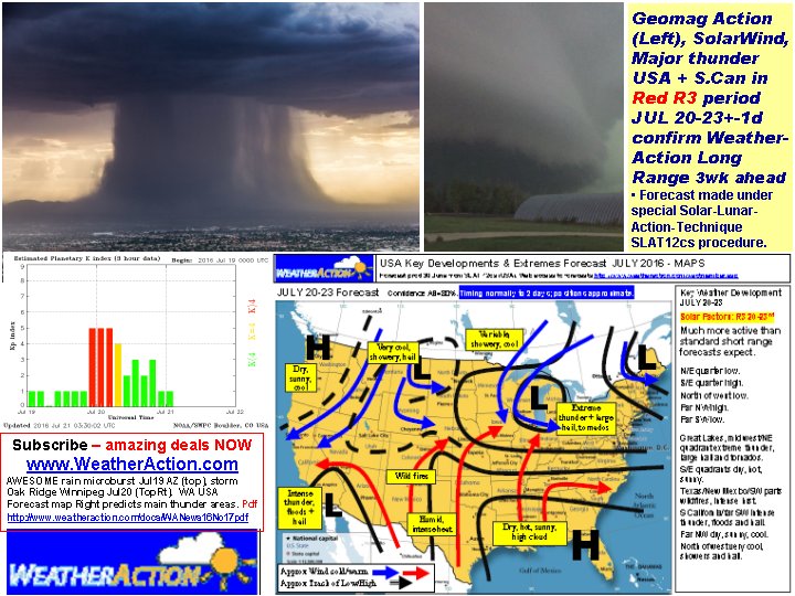
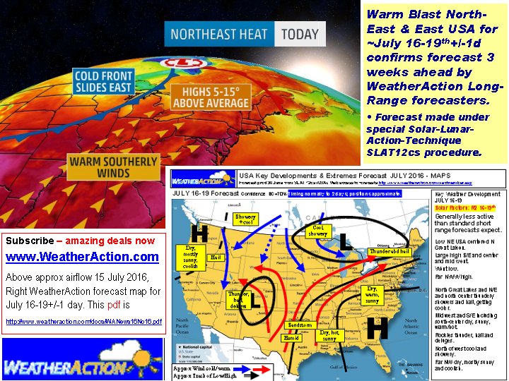
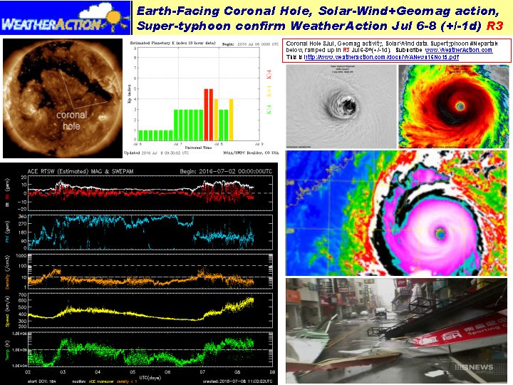


 Earth facing Coronal hole 26May solar wind Earth 26-27May