Comments from Piers
WeatherAction
  • Going to parts other forecasters cannot reach!
Delta House, 175-177 Borough High Street. London SE1 1HR +44(0)207939 9946 From Piers Corbyn +44(0)7958713320  piers@weatheraction.com  www.weatheraction.com Twitter address Piers_Corbyn
 
Jan 10th and ongoing Comment post. Extra points from Piers Jan 12th

Breaking News snips (newest on top) 

=> Tue15/Wed16 FEBRUARY 2013 - A month of Wild Contrasts - 45d Brit+Ire Forecast is now loaded 
NEWS CONTENT:  Piers says "BBC-MO credibility is near a tipping point"

=> Tue 15 Jan 05.00am SPECIAL UPDATE on WHAT WE EXPECT in R5+ 17-20th Jan and QV5+ 16-19th & Sudden Stratospheric warming event has been loaded into Forecast Services: B+I 45d, Euro-maps and World Red-warnings/Thunder-Tornado/Quake trials (Extreme Events Rest Of World) 

=> Mon 14th Jan pre-dawn Snow Whitstable Kent  

1. WeatherAction News Release and Public Warning 10 Jan 2013
- SUMMARY PUBLIC FORECAST issued because of the importance of what lies ahead for the UK and Ireland - part carried on Daily Express front page 10 Jan:  bit.ly/ULznvo
Full detailed forecast B+I (and equally important forecasts for USA and Eu)  available via: http://www.weatheraction.com/wactmember5.asp 
NB: Substantial discounts for 6months (charged as for 5) and 12 month (charged for 9) subs

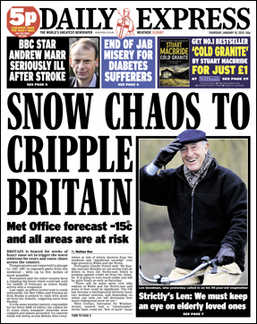
Extreme cold, blizzards and snow drifts "many feet deep" to bring chaos to England and Wales for at least three weeks - into early Feb

·   WeatherAction forecast issued ahead of all others
This catastrophic forecast scenario was first issued in detail in mid-December by WeatherAction long range forecasters and is now starting to come true.  "Other forecasters are just starting to agree with us three weeks late but they don’t realize how severe this is going to be", said Piers Corbyn, astrophysicist of WeratherAction.com
"Our solar-lunar based forecast predicted generally increasingly cold and very cold weather from around Sat 12th Jan for Britain and Ireland. Next, waves of major Arctic blasts and blizzards with many feet of drifting snow are likely in places from around 20th with another major blizzardy blast around the begining of February.  
"England and Wales including the South are likely to get the deepest snow, while Scotland and Northern parts of Ireland will probably be very cold rather than very snowy. Some of the SouthWest of Britain and Ireland will probably get rain rather than snow at times.

·        Sudden stratospheric warmings forecast breakthrough
"There will be fluctuations in the severity of this weather but our confidence in this general forecast is increased by our new breakthrough in predicting major sudden warmings of the polar stratosphere, which in a contradictory way drive blasts of very cold air south.  
"Although there is something of a 'stratospheric warming' developing now 10 Jan", said Piers, "we expect more intense 'sudden stratospheric warmings' and related cold blasts around quite well defined dates to come. We are 85% sure of this general picture and further details of the weather and stratosphere forecasts can be found via our website www.weatheraction.com ".
WeatherAction expect snow amounts to be as bad or worse than the record-breaking December 2010 - which they also predicted.  
"Dr  Richard Wild, snow-expert at Weathernet advises that previous significant snow blasts in the last 10 years before Dec 2010 in England and Wales were: begining Jan 2010, 8-9 Feb 2007, Feb 1996 and Jan 1993", said Piers.
"These extreme events are entirely driven by solar activity and lunar factors and nothing to do with changes in CO2 which have no effect whatsoever on weather or climate", he added.

What to Look out for in coming events

The Brit+Ire 30day forecast carries key dates of WeatherAction predicted SUDDEN polar stratospheric warmings and expected key surface pressure and weather events. 

Further detail is in Eu pressure forecasts & commentary and RTQ (Red Warning, Thunder/tornado and Quake (trial) (Extreme Events Rest Of world) Forecasts
=> These are available as part of the Eu 30day service and B+I 45d service on
http://www.weatheraction.com/wactmember5.asp

Note subscriptions NOW to B+I 45d service get these December pdfs AND on 15th Jan also get the B+I 45d forecast for Feb.  Seize the time!

INFORMATION: Standard moving model smoothed record and projections of 30mb temps - showing temp of Stratosphere:  There are various measures around. WeatherAction forecast was issued Jan3, before these models had forecasts for the dates of WeatherAction SSWs.
Note Jan 14. The standard projections now show a rapid increase in Stratospheric temperature 17-21st with the red area in two halves spreading to roughly the whole of Asia and the whole of Canada plus the northern half of USA.  We are monitoring this as well as Pressures especially Greenland High and Scandinavian High. Solar Active regions AR1656 to AR1654 are near Earth facing 14th and AR1654 is very large http://spaceweather.com/archive.php?month=01&day=14&year=2013&view=view
 
(added Jan 12) BBC-MetO opportunism on Sudden Stratospheric Warmings (SSWs) could begin their terminal decline as scientifically credible institutions.
 says Piers Corbyn, astrophysicist of WeatherAction.

"The pathetically opportunist public 'revelations' by the BBC-MO of the importance of (polar) sudden stratospheric warmings in the advent of cold blasts after WeatherAction's explicit prediction (Jan 3) of such events to come; and their failure to acknowledge WeatherAction and associates of their work, shows they will stop at nothing to try to shore up their failed 'weather drives weather', warmist, approaches to medium and long range forecasting.
Peter Gibbs video on the matter http://www.bbc.co.uk/weather/feeds/20992173 is well explained and informative but the intro "Forecasters have found a link between sudden warming in the stratosphere and unusual weather patterns" conceals their own (effectively admitted in the vid) failure to know which SSWs will cause cold blasts or when SSWs will come or where they come from shows 'the forecasters' could not have originally been the Met Office. The piece and (less so) Paul Hudson's earlier piece http://www.bbc.co.uk/blogs/paulhudson/2012/10/a-step-forward-in-forecasting.shtml in the matter was produced to make it look as if the MO might have a grip of the matters when they ONLY started talking about them after we at WeatherAction stated the cold blast to come (which they didnt expect anyway) would be 'SSW creatures'. Their opportunusm will however bite them back.
Ask from where do SSWs come? 
The intellectually challenged 'science' that holds a change of atmosperic CO2 concentration from ~0.03% to ~0.031% (the 0.001% being Man's contribution) could cause Hurricane Sandy to take a left turn and head for New York and trigger all manner of other extremes in 2011 and 2012 (many of which were in fact predicted using solar activity weeks and months ahead) is delusional enough. The idea that SSWs at 10-50km above the Earth are also driven by trivial changes in concentrations of a trace gas - CO2 [which MUST be the case if CO2 is the father of all these extreme] is stupid beyond imagination. And what of the Earth-facing extreme events on the sun when major SSWs happen? Are they put there by Peter Gibbs driving his car past some tipping point?

SSWs are driven by solar activity and we at WeatherAction are predicting the major ones, and their solar drivers, which cause NH winter important cold blasts; whereas standard Met has no such long range predictive skill on SSWs or anything This shows two things:
(i) The fundamental tenet of standard meteorology that weather primarily drives weather and all external influences are minimal - which means SSWs are driven from below - is past its sell-by date.
(ii) SSWs are nothing to do with CO2.
WOULD THE BBC-METO CARE TO DISCUSS THESE MATTERS WITH US ON TV WHEN MUCH OF BRITAIN IS SUFFERING UNDER EXTREME COLD BLASTS AND/OR HUGE SNOWDRIFTS?
(Recall They expected a mild January)

CO2 warmists in double whammy retreat

·  UKMetO bends towards WeatherAction cold forecast! Standard Met can't cope with new reality of coming new LittleIceAge Superb graph from Joe Bastardi: bit.ly/Vf8Vtr
·  Campaign message of the week : LEARN, UNDERSTAND AND PASS ON!
FACT: Met Office data is still fraud THE WORLD IS COOLING bit.ly/UkErVX
Almost Right! UKMetO DOWNGRADE 'Global Warming'!!  bit.ly/11cTHv5 
For the facts of CO2 warmist fraud by MetO-BBC-CRU (Uni of East Anglia) see http://twitpic.com/bu5bw1/full 
 
2. Latest News / Recent Regular WeatherActionTV reports:
● Jan Forecast news B+I, Eu, USA, Quakes/thunder - Extreme Events world bit.ly/Vf8Vtr ● For great (rest of) Winter offer & forecast Services news see sect 2 in past post:
 http://bit.ly/U63E6a  
NEWS REPORTS IN news sections of WeatherAction 30day JAN 2013 forecast pdfs
Europe WeatherAction Dec forecast won through - Report twitpic.com/brwxlq/full  
Brit+Ire WeatherAction Dec forecast wins battle of Britain - Report http://http://twitpic.com/brx0hw/full 
USA WeatherAction Dec Extremes forecast 'brilliant' Report 
twitpic.com/brx1gi/full 
 
2a Breach of copyright on WeatherOutlook site (posting/link since removed).
This is a serious matter. A legal letter was sent to WeatherOutlook and the matter is being considered and further investigated. We thank those who informed us of the information/links concerned on WeatherOutlook site.

2b Recent WeatherActionTV VIDEOS 
http://www.youtube.com/WeatherActionTV
Green Isn’t Working – Accountability now!
http://www.youtube.com/watch?v=i09WTST80Rs&feature=plcp
BBC invited to ‘Climate Fools day event'  31 Oct 2012
http://www.youtube.com/watch?v=wm_S8mCHZrI&feature=plcp

3. WeatherAction forecast information and Standard Links
WeatherAction Forecasts include news items related to forecasts and forecast advances
To go straight to Subscription shop link (Brit+Ire, Europe, USA, Quakes and Red Weather warnings):http://www.weatheraction.com/wactmember5.asp
For a handy guide to WHAT YOU GET AS A WeatherAction Web SUBSCRIBER and subscriber link, see: http://t.co/JkFE1F9M 
3a) Relevant links for comments on models and what they are up-to
(i) http://www.weatheronline.co.uk/cgi-app/weathercharts?LANG=en&MAPS=vtx&CONT=euro&LAND=__&ZEIT=201212070600   
 (ii) ecmwf Pressure
http://www.weatheronline.co.uk/cgi-bin/expertcharts?LANG=en&MENU=0000000000&CONT=euro&MODELL=ecmwf&MODELLTYP=1&BASE=-&VAR=pslv&HH=240&ZOOM=0&ARCHIV=0&RES=0&WMO=&PERIOD=
(iii) GFS Pressurehttp://www.weatheronline.co.uk/cgi-bin/expertcharts?LANG=en&MENU=0000000000&CONT=euro&MODELL=gfs&MODELLTYP=1&BASE=-&VAR=pslv&HH=240&ZOOM=0&ARCHIV=0&RES=0&WMO=&PERIOD=
(iv) Netweather JetStream forecast report - Recommended 
http://www.netweather.tv/index.cgi?action=jetstream;sess 

4. READERS COMMENTS & FEEDBACK:
THIS Site is 100% Moderated and troll-free because of ongoing cyber flood attacks and to stop postings not of fair and honest intent.  THANK YOU for the many well informed comments on this site. All fair comment including critical points are published. Exceptions to publication are: 
- pharmacy-obscene-spam, obscene terms, and libel (Note WeatherAction publishing site as well as original libels are culpable since publication was allowed). 
- items which reveal paid forecast detail, 
- items which are in a large part clearly false in which case writers get a direct response, 
- items which are totally irrelevant and/or trollish in which case they may be advised on where to go.
 
Note
 when commenting on recent forecasts by WeatherAction or others please refer to full forecast words as far as possible as some summaries / notes circulated, ‘reports’ of forecasts have been or can be misleading. Also include actual obs / links where possible. Please give working links when you refer to other articles/sites. Thank you.
NOTE Previous comment blogs eg http://www.weatheraction.com/displayarticle.asp?a=490&c=5 carry more Reader comments on previous weather.


Comments submitted - 149 Add your comment

On 22 Feb 2013, Abhishek wrote:

Evil is falling down like a pack of cards, Tunisia, Egypt, iitnmenmly Libya, Algeria, Morocco, maybe Iran and this morning it was on thenews even North Korea ahs seen some protests.Climate Change politics is in an analogous situation. It may take a bit more than a while, bit it will fall.The Met office asking for more money to increase its computer power is analogous to Geddafi asking for more money to buy more bullet power. But like Geddafi, AGW will fall, crash, soon.
On 17 Jan 2013, Clive wrote:

If we are losing the gulf stream as we head towards the next little ice age isn't the case that the west would receive more snow than before because there is nothing to stop the regular cold conditions now affect the east from affecting the west as well. As the west is wetter than the east more of the rain in the west would turn to snow in the winter. The frequency of snow would increase. The south west geographically is near Europe that the north west which makes it the most continental side of the west and would receive more in the way of cold weather from Europe.
On 17 Jan 2013, Philippe (Alsace) wrote:

from milder weather on sunday as "forecasted" until yesterday, the french MO is now revising for more lasting cold and snow. But it seems very difficult for them to admit the cold spell could intensify or last longer...I think it's the models... somme snow pictures: http://news.fr.msn.com/m6-actualite/france/neige-vos-plus-belles-photos
On 17 Jan 2013, Piers_Corbyn (twitter address) wrote:

ALLTHANK YOU - A SUPERB lot of informed comments and OBSERVATIONS - Yes Our reality is what IS, rather than computer MODELS which right now are largely what is NOT. It is remarkable how so many beleive in the latest model map when the last 6 have been wrong. However do not ignore them, we learn from these times (but standrad modellers dont do much 'learning'). When our solar-lunar influence is biggest is when standard models go most wrong and will have a relaibility horizon of only about 24hours for the coming 6 days - ie until 21/22nd Jan. So YES to loads of questions, See the new blog but 1. Everywhere will get more intense events than 24/12hr ahead standard maps INCLUDING BELGIUM, EUROPE USA, THE WORLD. This SSW is a record breaker in observed stratospheric warming terms already. 2. To Change their maps into reality note (a) Prob ALL their fronts will be more active - isobars tighter (b) Greenland/Scand highs develop (see main note (c) Double or treble snow in TV fcsts.
On 16 Jan 2013, Nino VAN EECKHOUT wrote:

Piers, It's clear from your predictions that the UK is going to be hit quite badly on Friday. Do we need to take precoutions in Belgium as well. Don't need details, but a hint would be nice since I don't believe our weatherforcasters anymore and I don't want to be in any misery during the coming weekend...
On 16 Jan 2013, Jim M wrote:

Hi Piers, well done on the Jan forecast. Could I ask whether you feel the imminent R5+ event will have any impact on the 'Snow event' that is about to sweep the country i.e. that it may displace the computer model projections either by reducing snow or enhancing snow? Many thanks. Jim
On 16 Jan 2013, Helen dolan wrote:

Please can you advice me if we will still be able to get to london on Friday lunchtime train from huddersfield West Yorkshire from Manchester Piccadilly we have poked tickets and hotel for weekend away I am getting very worried now about the blizzards which will come I pray that they will hit in the afternoon this weekend has been booked for months
On 16 Jan 2013, Dawn wrote:

New Met Office Botch: Climate Scientists Get The Stratosphere Wrong: http://www.thegwpf.org/met-office-botch-climate-scientists-stratosphere-wrong/
On 16 Jan 2013, Rosebud wrote:

Devon Dave - check out the latest fax charts, looking a bit special for the SW, I'm in Tiegnmouth and hoping the charts are on the money! Exciting times....
On 16 Jan 2013, Whenthesethings wrote:

Some models now showing friday's front turning into a split low with the main snow area diving south. http://www.myweather2.com This could result in large accumulations from Wales to south midlands to south east England. Then a strong easily digs in bringing heavy snow showers to eastern England. Exactly what is shown on Piers' map. http://climaterealists.com/index.php?id=10957 Going to enjoy seeing how this one plays out :)
On 16 Jan 2013, paul wrote:

Hi Piers do you think that the impossible could happen in this current cold spell and that it could snow in the very west of ireland, we got a small dusting in 2010 which is very rare. the gulf stream keeps us mild every winter. i bought your december forecast back in november. but dont have the january forecast because cant afford it at the moment, dont need dates just that if theres that small chance that thoses cold easterly winds could reach us so that we could get a few flakes instead of rain all the time. keep up the brillant work that you do so well!
On 16 Jan 2013, MattL wrote:

Piers, I found this summary of an article from Nature, dated 1950. I don't know if it has any relevance to your own method of weather forecasting but I thought you might be interested all the same: FOR some ten years, at the Zi Ka Wei Observatory, in Shanghai, China, we have been using, with exceptional success, a new technique in our weather forecasting. This method is based on an as yet unexplained correlation between the usual ionosphere echoes (E, F and F 2) and the future movement or behaviour of the three main air masses, which make the weather all over the world: polar, maritime and tropical, or equatorial, as some people call it. Our results have already been published in the Bulletin of the Meteorological Society of America, in 1946, and in a paper sent to the last Pacific Science Congress held in New Zealand last February.
On 16 Jan 2013, Nick Stoneman wrote:

We live in West Wales (about 7 miles north of Carmarthen), so the Atlantic keeps it mild. But we are in a frost pocket, and that makes clear winter nights much colder - friends at the bottom of the valley had -20C Christmas night 2011! It started snowing here at about 7.00pm this evening. Only light, and it's not settling, but a sign of things to come. As all 5 roads out of the village are up steep hillsides it could be interesting in the morning! Tomorrow is the 17th. Now when did Piers say the snow would start in earnest for us in the west? Kudos Piers! Having been a subscriber for 14 months, I have seen your accuracy increase remarkably over that time. I know you only claim 75% accuracy for your long range forecasts, but I get the impression you are running at 85%+
On 16 Jan 2013, james h wrote:

dont wana sound stupid but do i just get the jan forcast for 15 days after that its gone? anyone
On 16 Jan 2013, Nino VAN EECKHOUT wrote:

Hi Piers, seems you're getting it right again. 2 days ago national weather forecast in Belgium predicted that there would come an end to the cold weather next Sunday. Today they've altered there prediction. Now they're saying it might snow "a little" on Saturday and there will be a slight warming on Sunday and Monday, but after that the cold would snap back !!! My guess is that by Friday evening they won't be talking about "the slight warming" and " a little" amount of snow.
On 16 Jan 2013, Devon Dave wrote:

DEREK - you mention snow on Monday in the West - presumably that's part of Piers forecast and not the MO?
On 16 Jan 2013, Nick wrote:

I can never work out whether the BBC/MO get it wrong because of sheer incompetence or because of some false science/policy based conspiracy. BBC Weather has dumbed down considerably. A five day forecast can change five times a day, informative things like surface pressure forecasts and frontal systems have been removed from broadcasts. Their vague colours moving across maps which are supposed to represent precipitation, indicative temperature etc have no precision whatsoever and for me is code for we dont have a clue because no reasonably exact detail can be interpreted at all.
On 16 Jan 2013, Paul, Bedfordshire wrote:

Wattisham already down to -7.4 at 18.00, two other locations down to -7.2 at 18.00. Are we looking at -16 by morning I wonder?
On 16 Jan 2013, Ruairi (East coast of Ireland) wrote:

Piers you have done it again! The major weather event in your forecast looks likely to happpen! Just hope we get some of that snow here we are on the border of the cold/mild air. It has rained here during the week with some sleet, but no snow!
On 16 Jan 2013, Kevster wrote:

Piers' forecast looking good. Is it time to start publishing forecast validations so that the scientific community will take notice?
On 16 Jan 2013, brandon wrote:

right im really hoping i get off work friday consider that as a long weekend because of the apparent forecast for blzzards for the south on friday but rain in west but how far will that come from cornwall before it turns to snow i really want to know if that will turn to snow by the time it hits portsmouth/hampshire like 2010 rained heavy at first then when lost hope BANG blizzard like snow conditions put us southern counties into a standstill!
On 16 Jan 2013, willy wrote:

Congrats on yet another wonderful long term forcast. Piers given a beta gamma has developed, making an X class flare possible, would I be right in thinking that this could (if developed) have a hugh (further) affect for the SSW? Thanks Willy
On 16 Jan 2013, BLACK PEARL wrote:

On 16 Jan 2013, Derek Cummings wrote: "" I hope the government at last listens to what you have to say and as you say, while the country is at a standstill with the coming snow, agree to talk to you about using your input to what in the end will save the UK a lot of money by being prepared"" ****** They dont want to know They want to keep the public perception & opinion on warming & carbon ... CO2 or now the latest black carbon. They need your money Bloody excellent forcast Piers The MetO (&BBC) must be squirming Ho Ho Ho keep 'em coming & coming driving the nail in deeper.....
On 16 Jan 2013, Derek Cummings wrote:

I really do take my hat off to you Piers. You forecast the date it would turn cold about the right right, and heavy snow that is about to come and probably bring the Uk in parts to a standstill almost spot on the date. I also notice looking at the charts more snow is likely to hit our shores, at least in the West on Monday. And the cold is expected to stay, even though the charts at the least 'wobbly' at times. All the power to your elbow. I hope the government at last listens to what you have to say and as you say, while the country is at a standstill with the coming snow, agree to talk to you about using your input to what in the end will save the UK a lot of money by being prepared:-)
On 16 Jan 2013, Devon Dave - wrote:

Enjoy what's coming you lucky people who live away from the SW - that's if you like snow. The last big fall we had here in Exmouth in Dec 2010 deposited 17cm - no chance of that this time. We'll get wet while you get white!
On 16 Jan 2013, Steve.K wrote:

(Repaired message) - "I watched this on BBC 2 "The polar bear family and me". I had to have a rye smile as the bloke on the camera was getting a bit nervous as he was surrounded by at least 12 polar bears of various sizes, I thought that polar bears were an endangered species, not according to this broadcast. Hope you all get the snow that Piers forecast back in Dec,The Beeb say it may snow on the 18th, now what a surprise, Well done Piers."
On 16 Jan 2013, Paul wrote:

Actually got a the coldest night of this winter in Lowestoft at -7c with a slight covering of soft hail.
On 16 Jan 2013, Ron Greer wrote:

Well, would you believe it Piers, I managed to get John Cogger to admit that you 'almost got it right' about the temperature minimum and now I am pointing how close the current synoptic chart is to your predictions from several weeks ago
On 16 Jan 2013, Russ wrote:

PaulG....I'd wait a day or two and see what happens before getting too depressed.
On 16 Jan 2013, Paul G wrote:

...Well it looks like its going to be another boring winter here in the east of Ireland,with mildish and wet conditions.So annoying! ! ! ! !
On 16 Jan 2013, Russ wrote:

Confirmation that Glynn is now ecstatically happy..>> http://www.bbc.co.uk/news/uk-england-norfolk-21038913 <<..
On 16 Jan 2013, Russ wrote:

My son just got home on his motorcycle with a picture on his phone of Rime Ice all over his machine. As he rode home it started melting, then formed again as he rode along through the freezing mist. He even had ice forming on his visor. Several of his work mates said that they recorded -8C in their cars last night travelling to work around midnight.
On 16 Jan 2013, Minnow wrote:

I saw someone asking for a weather update from Norfolk, well North Norfolk and into Norwich last night was -13C in places, the Airport in the city is -10C and closed last time I heard, many roads are sheet ice and the snowfall total here in North Norfolk was 7" so not the 100mm they keep going on about, nearly double that, Norwich last night was a disaster movie in the making, people taking many hours to take quite short drives, North walsham to Norwich took someone 7 hours !!!!! So yes we had and have snow, and it's not going to leave before we get more and the temps are low now due to so much snow cover. Glad I took the forecast advice, 4x4 is serviced, coal and logs stocked and shopping done :-)
On 16 Jan 2013, mike wrote:

Hi All, models are changing all the time regarding how far east this front will get on Friday. Will it make it to kent and the southeast or will it stall over central parts. Think we will have to wait until the day to be sure. Hope everyone gets what they want.
On 16 Jan 2013, Paul wrote:

I wish UK would have an anticyclonic summer for a change. We could do with a summer of blue skies and sunshine rather that the dully grey rainy conditions of late. We would certainly have a different outlook to life what we have now and it would cheer us up have years of gloom.
On 16 Jan 2013, Colin wrote:

That chap from Norwich has gone quiet lol? Plenty of snow and ice here now!
On 16 Jan 2013, Fed_up wrote:

OK, Piers...what kind of sourcery is this???? The BBC /MO forecast last night (10.35pm BBC1) gave the forecast for Friday. In terms of Geography their graphic matched EXACTLY your forecast issued weeks ago. The Southwest was an outlier with only rain forecast. MO still seem clueless about depth of snow. I am not buying this, there is NO WAY you can forecast where both the precipitation and cold will collide with that accuracy and that far ahead (even though you have!). It is clear to me that your forecasts use some sort of dark arts - do you sacrifice a goat before preparing your forecasts? :D Astonishing work, Piers....well done!
On 16 Jan 2013, Ron Greer wrote:

Kevin: I think my post, just after yours, answers the question, but if you are not too sure yet, I suggest you take a look at the forecast Piers has generously made available on ClimateRealists.com. You will see that he has for the 17th -21st period mentioned the advancing weatherfront from the SW and that the precipitation may turn to rain in the West Country, whilst much of the rest of the country gets very heavy snow. The MO-Beeb have just wakened up to this reality.
On 16 Jan 2013, Susan wrote:

Met Eireann our Irish National forecaster are forecasting: On Saturday night rain will develop across the country and the rain will continue to persist in many places right through Sunday. It will be a wet 24 hours with rainfall in excess of 25 mm in many places. Will this fall as snow for us or will it turn nasty as it meets frigid air in UK..interesting weekend ahead. Piers has said big changes on 20th so we'll see.
On 16 Jan 2013, RonGreer wrote:

Piiers: Just had the pleasure of reminding John Cogger on the Hudson siite just how accurate your predictions were: you predicted down to 16C in much of north/central UK and dry---we actually got -13--not bad at all from so far out. The Beeb gave at least 4 estimates for minima in the last 48hrs. Yes, and now in the 17-21 st period we now have those blizzards are coming along. Well done.
On 16 Jan 2013, kevin wrote:

Peirs do youthink the met has got the forecast right ?snow friday slowly turning to rain in western UK ?
On 16 Jan 2013, maria wrote:

Biggest congratulations to Piers. His forecast released on 17th dec for jan is spot on and my arrangements made then, stand good now. Also many thanks for the excellent informative update. My second yearly sub and worth every last penny
On 15 Jan 2013, Lynne wrote:

Piers - would you be able to issue some comment about how your Jan 17-21 forecast is holding up? There's an obvious turning point here in your forecast and it would be good to hear how you think your late Dec prediction for January is holding up. I notice that the BBC/MO forecasts are converging on your prediction, but there are many 'uncertainties' still (apparently). Kind regards.
On 15 Jan 2013, Tom Carry wrote:

Blizzard like conditions expected for the south this Friday into the week end the same time period Piers predicted weeks ago, well done Piers!
On 15 Jan 2013, Cal wrote:

Congratulations Piers, quite an accurate forecast for Jan, esp the specifics wrt detail, i'm impressed and as a result you can look forward to more subscriptions, the only downside i see is the overblown emphasis or rather media-hype with these forecasts, apologies if i sound negative here, but surely if you are confident in your forecasts there's no need to go overboard? Keep up the good work, look forward to seeing the rest of 2013 forecasts. Regards Cal.
On 15 Jan 2013, Kevster wrote:

For all those bored of the fashionable but dumbed-down SSW stuff in the media, here's a reasonable paper with relevance to the current situation http://www.ann-geophys.net/28/2133/2010/angeo-28-2133-2010.pdf Plenty of links to other papers there as well, all from well before the mass media got hold of it!!
On 15 Jan 2013, Rosebud wrote:

I remember the summer of 2006 - easterlies all summer - remember it well as i do a lot of wake boarding in the summer and the sea was too choppy - normally protected from South Westerlys. Clive - i really hope you're right - being in the SW we tend to get rain followed by more rain. Piers did you forecast the snow in the SW back in Jan 2010 - i wasn't following you then and i know that no one else forecast it for us - caught the council gritters and snow ploughs totally on the hop. Also someone mentioned an update to the Jan forecast for this wkend, is there one?
On 15 Jan 2013, Clive wrote:

There is a possibility of a situation that happened on many occasions in the late 70s and often in the 1980s. The Low pressure may stay to the SW of UK and strength the easterlies and this could bring more and more cold air in causing the rain to turn into snow well out at sea before the front pushes in. If this happens we could have a blizzard similar to that of January 1982 occurring.
On 15 Jan 2013, Paul, Bedfordshire wrote:

Met office now has severe weather warning for Friday for NI, Wales and Western England warning of possibility of "Blizzard Conditions" and possible travel disruption
On 15 Jan 2013, Russ wrote:

mwhite.....nice link, thanks for that. Hard to believe they are now stating that back in 2009 they saw the cold coming and associated it with sudden stratospheric warming. They didn't see the snow coming until the clouds were visible on the horizon as usual....
On 15 Jan 2013, Russ wrote:

Kevster....understood. I queried the constant easterlies several years ago, just before the sun spot minimum, must have been around 2006'ish, the Met office persons reply was that Britain often had long periods of easterlies. Uh? Yet I had explained that easterly winds in Derbyshire were as common as Yak hair and that persistent easterlies for weeks and weeks on end was just plain wrong. Didn't phase the Met guy. Common they are, east winds, perfectly normal he said. I hadn't found Piers back then so still haven't a clue why those east winds blew for the most part of 6 months. Started in early winter and didn't end till mid summer if my memory serves. Craig...you're an expert 'specially on old data. Can you remember those persistent easterlies? Happened for maybe two or three years on and off..... Glynn might have emigrated to Sweden. Either that or he's in a coma after the shock of hearing that lots of snow is on its way hehehehe.
On 15 Jan 2013, Ron Greer wrote:

Thanks Stephen---I hope Glenn built a snowman!
On 15 Jan 2013, mwhite wrote:

Sudden stratospheric warming caused by the weather???????? http://www.bbc.co.uk/weather/features/20998895 I think that's what he said
On 15 Jan 2013, Stephen wrote:

Ron Geer, can safely say we had 17.5cm here in mid norfolk this morning. Temperatures stayed below freezing all day with spectacular blizzard for 45 mins from midday. Norwich became grid locked with frozen treacherous roads. Snow a beautiful sight!
On 15 Jan 2013, Sue wrote:

Two elderly folk were found to have died from hypothermia in Dublin at the weekend and we haven't experienced the very low temperatures our friends in the UK are getting, we are all excited about the coming cold snap but let's not forget our vulnerable neighbours as temperatures plunge, Piers has given us a heads up early let's use it for good and make it our business to check up on them.
On 15 Jan 2013, Paul, Bedfordshire wrote:

Latest local met office for me (Ampthill) is now showing -2 light snow, winds 13mph, gusting 25mph. As we we will be right in the middle of an R5+ it does not take much amplification to become howling winds and heavy snow = blizzards plus deep snow drifts. Game on
On 15 Jan 2013, Dean C wrote:

Just as I added my last comment the latest updated GFS from netweather is more confused than ever showing what appears to be an easterly airflow from the 20th, these GFS models are clearly out of their depths and seem to completely change many times over a 24 hour period, but so far for this cold snap all the models that I have seen have leaned over to Weatheractions forecast with most being far from accurate until just a half day or so in advance. I continue to be impressed, Good work Piers
On 15 Jan 2013, Dean C wrote:

It looks like we have another air mass battle going on between the Atlantic and the Continent, models are still going from one to the other of which will eventually win out with the uk being in the middle. Charts are generally favoring the Atlantic to eventually win out but it looks like there could still be enough air being dragged in from the continent to make it quite cold at times which could give the chance of a fair bit of white stuff. All being said a couple of hundred miles either way of where the pressure charts are could make a massive difference between mild or bitter conditions over the month.
On 15 Jan 2013, Ibbo wrote:

What's interesting is the met office models forecasting westerlies to encroach by this weekend, with the warmer westerly air winning. Last weekend they had westerlies over the uk with a band of rain forecast on sunday for the Thursday, I know this as as needed a forecast for sport purposes. The forecast was for rain, similar to this coming weekend, with a westerly progression across the UK. After last weeks declarable of a forecast, i'm hazarding a guess of easterlies dominating much more the Met-Office models, they seem rubbish forecasting weather when its not moving across the atlantic, but coming in from the east. Much more snow i think for the next weeks.....
On 15 Jan 2013, Ron Greer wrote:

It would appear from the Beeb charts that Norfoilk is getting snow and willl get more. Anyone know if it's snowed in Norwich? Glenn where are you?
On 15 Jan 2013, stephen parker wrote:

Are we 30 day subscribers not worthy of the january updates?
On 15 Jan 2013, GThomas wrote:

@ Nino – I was looking at the live webcam for Bruges (Market Square) last night as I'm going there in a couple of weeks and hoping for snow. And it certainly seemed to be blowing a blizzard there for a good few hours. Fingers crossed it'll be nice and wintry while I'm there.
On 15 Jan 2013, Paul wrote:

Last night 14th it rained in Lowestoft then turned to sleet then snow which settled. By morning nearly all of it had melted. The cold spell is not that cold so far.
On 15 Jan 2013, Nino VAN EECKHOUT wrote:

Belgium was hit by a little blizzard that lasted for about 3 hours yesterday evening. Result was 4 inches of snow. Earlier predictions were for less snow, but as we came near the moment of truth, national weather forcasters adjusted their predictions. Forcast is now that it'll freeze until Sunday with snow on Sunday that'll turn into rain and warmer temps next week. I really wonder what will happen now, because it's not a 100% sure this will happen they say. If you keep all options open you're always right ofcourse....
On 15 Jan 2013, Kevster wrote:

Nick - Agreed! I meant a chart (or charts) like that one rather than that one in particular. Most temperature graphs show a similar warming pattern for the past 100 years (I'm not going to get into the debate whether the warming is natural or man-made!!). All I'm saying is that this would eventually provide the evidence of a LIA. Russ - Agreed as well. I didn't mean a graph would give predictions. I meant it would provide the evidence once a LIA has arrived as you suggested. BTW, I think Gibbs meant surface wind reversal, not the jet. Makes more sense that way.
On 15 Jan 2013, Nick Stoneman wrote:

Hi Kevster. Interesting chart - but I mentioned a body of evidence. Just as a blizzard doesn't prove things one way or another, I would not rely on one chart. Plus we would have to consider the reliability of any evidence, be it a chart or anything else. The chart you mention says it is based on "Smith et al. (2008) methodology." So is that methodology reliable? Where did they obtain the raw data? Are those raw data reliable? How comprehensive are they? How closely does the chart follow Smith et al's methodology? And does it go back far enough to give a proper indication? The most recent equivalent to what we are facing is about 1700AD in solar activity terms - I don't suppose there are enough reliable & comprehensive temperature data for a temperature chart by itself to be especially meaningful. If the chart fell by 1C it COULD be an indicator of a transition to LIA weather, but only if the data & methodology are reliable and comprehensive. Plus we'd have to consider other data.
On 15 Jan 2013, Russ wrote:

All the mouth breathers were out this morning driving like they had all just had an unsuccessful frontal lobotomy. Slowing at 10mph for junctions I had several tailgaters, just one car length off my bumper as my ABS started cutting in and the car was sliding. Next junction, same problem. Very very slippery even on gritted roads. Pavements were better as the ice was of the crunchy crystal type. Very grippy!
On 15 Jan 2013, Russ wrote:

Kevster.... NASA \ NOAA will only announce LIA conditions once they have already occurred as they have no idea how to predict them. Piers predicts, NASA\ MO tell us what we already know. ... Nick.... I think you've hit the shiny nail head there. Warmer times give much more stable weather, and more easily predictable weather, whereas LIA puts huge swings of instability into the equation. We can see this already having it's effect on standard meteorology with their complete confusion and desperate plagiarism, they still can't see what's coming just over a week away. Plus they haven't got a clue why these things are occurring. As Piers points out above, Mr Gibbs simply stated that the stratosphere warms, the jet reverses direction, and this causes persistent and cold Easterly winds. But Mr Gibbs looked like he'd been caught with his hand in the cookie jar. The jet doesn't change direction, parts of it simply pull S in a loop, and the winds caused are not E'erly, they are mostly NNW'erly.
On 15 Jan 2013, Steve Devine wrote:

Stunning Jan forecast accuracy so far Piers! Now all eyes to the Atlantic as it tries to make in-roads between Friday - Monday. Early indications are that Wales and SW England will get some serious accumulations in the early weekend, followed by the eastern half of the UK overnight Saturday into Sunday. London is currently on the border between wet snow/sleet and accumulations of deep snow. The further N/E you are, the better. (http://www.netweather.tv/index.cgi?action=charts;type=fax;sess=)
On 15 Jan 2013, simon cochrane wrote:

I think its important to remember we are in an Lia entry period too so we are just beginning to see the effects like jet stream fluctuations.
On 15 Jan 2013, Kevster wrote:

To Nick - Surely the evidence for a LIA will appear on something like this http://www.ncdc.noaa.gov/sotc/service/global/lo-hem/201201-201210.gif So when we see the temperature fall by 1C or so over the next few years, that will confirm it?
On 14 Jan 2013, Nick Stoneman wrote:

When we think of full blown Ice Ages we tend to think of unremitting cold, snow, ice, glaciers. Recent research shows that even in full blown ice ages there were many mild breaks. So our assumptions about Ice Age weather are misleading. Similarly with our assumptions about Little Ice Age weather - it won't be constantly cold. The average temperatures will drop, but there will be many mild periods and even mild years - even some hot years. So let's not get too hung up on whether or not we get blizzards. My expectation is that we will have a blizzard soon, but if we don't get a blizzard it does NOT mean we are not in a LIA. Similarly, a blizzard would not of itself prove that we are in a LIA. It's the body of evidence, including Piers excellent work on the Solar/Lunar influence on our weather and the predictive value of it, which says we are almost certainly in a LIA.
On 14 Jan 2013, Nick Stoneman wrote:

Steve; Piers pointed out a couple of months ago that the weather during a Little Ice Age (LIA) is EXTREMELY variable. During a LIA, some winters will be mild - warm even. Some summers will be hot. The important thing is that MOST (not all) winters will be cold (or have extremely cold periods) & MOST (not all) summers will be cool & wet (or have cool wet periods). There will be more frequent periods of destructive weather - rain, giant hail, flooding, storms, gales, blizzards, extreme frosts, - even droughts & heat waves. But there will be lots of periods of frankly average weather. What we are experiencing is entirely compatible with LIA weather. For your info the actual weather we have experienced so far in January is very close to what Piers forecast. This month - & this winter - is nowhere near done yet. We're only 24 hours into cooler weather. One day of weather is NOT particularly relevant. The rest of the winter could be very interesting. Wait and see. Can be LIA even if average
On 14 Jan 2013, maw368 wrote:

Been a cold day in South Wales, not supposed to see much snow but there has been heavy snow this night but struggling to stick to wet surfaces in areas. a couple hundred metres and there has been very low visibility with heavy snow.
On 14 Jan 2013, Craig M wrote:

I made a little video showing the cold creeping west Link >> http://twitpic.com/bv93hr << excuse the poor outlines but it was to gives a rough idea. You can also see the mild sector initially push across N+Central Europe before retreating. Movement starts in the second week of Jan. Cold air, displaced from the Arctic, is moving to lower latitudes in a pincer movement via Scandinavia + continental Europe. 'Milder' air i.e. low 30's F (around freezing) features in N Scandinavia (off the map in vid). No matter what the MetO may claim about the SSW they have played it so safe their forecasts are worthless beyond a few days. Yes they knew a SSW was going to happen but that's a bit like saying 'it will possibly maybe snow this winter'. Most years it happens but where? when? Piers made one forecast two weeks ago. February is still a long way off.
On 14 Jan 2013, Ron Greer wrote:

Fed_Up( wish you used a real name) --Aye looks interesting, but mainly deallt with Canada and would be good if we could have implications for Europe and Britain/Ireland. MikeJos: are you in the official forecasting business and are you suggesting a the cold spell dissipating by the weekend?
On 14 Jan 2013, Russ wrote:

Sakia....I noticed a few days ago that new 'large' molehills had formed on my travels. Digging deeper to escape the cold perhaps?.... In NE Derbyshire this morning showed 10mm of snow, just about holding freezing for most of the day but little ice. The heavy snow when it came - erm - didn't. About another 12mm, maybe 15mm on high ground about 1000ft above sea level. Looking at the rain radar and the jet-stream loopyness is back so the Met Office should be spot on for tomorrow with hard frost and sheet ice. I always thought of skydiving as a dangerous pastime, but sometimes just driving to work can be more dangerous.
On 14 Jan 2013, steve wrote:

this is silly its makng me laugh loads in 2010 here in the south we got blizzards and predcted for coastal areas snow too what happens when i stick my head out a snowflake? a nice sized sleet? no its rain and now were on low risk according to the weather site metcheck yes mentioning of disruption england will be at a standstill to be fair its only london thats not the whole of england like in 2010 this is too hyped up in my liking not a real L.....I......A!!!
On 14 Jan 2013, William Downie wrote:

This is a reply to Saskia Steinhorst. I live in Scotland and my wife and I noticed a huge number of molehills on Saturday when we were out for a walk. We had snow yesterday but no deep cold yet. However, the forecast looks promising for hard frost from tonight.
On 14 Jan 2013, Saskia Steinhorst wrote:

The wind is the real killer here. On the island, actual temps are above -3C, but the wind chill is nearly -10! And on/off topic ... I always learned that moles become active when warmer weather approaches. However, these past 3 years I have noticed that they are active several days before a sudden and intense drop in temps. Anybody else been looking to the ground? :-)
On 14 Jan 2013, Nicholas Harrison wrote:

It's 15.40 in Eastbourne, between 4 and 5 C and it's raining as this big band sweeps though. According to the radar there's nearly 2 hours left for it pass over. We never usually get much Snow when it comes from West/North West, as we're somewhat protected by the Downs. But when I see talk of winds from the SE, then I make sure I'm prepared.
On 14 Jan 2013, MikeJos wrote:

Yes, ECM shows undercut slider end of week but also milder air by T168. Mostly rain after transient snow leading edge. GEFS shows less cold. A real big freeze has (a) much lower temperatures and (b) snow which lasts and without turning to rain. Battleground set up always leads to mild readily pushing ENE. If, and a big if, the scandi ridge ho'ds, there will be dry weather at w.end. I see no major event, unless wet snow before rain and rising temperatures. Tricky for a time but not worthy of the headlines.
On 14 Jan 2013, Fed_up wrote:

Interesting collection of blog postings on the possible imminent collapse of the polar vortex at this blog: http://theweathercentre.blogspot.co.uk/ Not sure what the implications are for U.K, if correct. Piers, do you have any info on this?
On 14 Jan 2013, Craig M wrote:

Last nights BBC forecast said rain but I woke to c. 1-2cm of snow which was in line with the MetO yellow warning. Snowballs fights possible but not snowman building. The snow, large wet flakes, for a time has been on and off but is finally dying out and brightening up but with only a couple hours of day light left. Deep cold is not in much of W+N/W Europe-yet but has been slowly creeping w/wards for the past week. Scandinavia + E/Central Europe are below freezing with sub -10C spots appearing. On Weds it was above freezing throughout most of europe. For me winter 09+10 started slowly with thaw in the day & increasingly colder days/nights (+odd 'milder' period/sector) before into the second week the deep cold/snow came. This is only an R1 period - the R5+ coming will be more interesting as FRED highlighted from one ECMWF run.
On 14 Jan 2013, Nick F wrote:

Observation: Currently relatively mild in Bristol certainly not cold enough for hats and gloves, a little bit of drizzle early on. Will be interesting to see how this progresses later on today and the rest of the week.
On 14 Jan 2013, Craig M wrote:

A general comment on the models - in the current set up the reliable time frame will only give a broad picture up to c.72-96hrs. Warm air from the Atlantic is pushing against cold air & the east/west adjustment affects the snow/rain line. Beyond this it really is take your pick with so many model solutions on offer. KEV G highlights the uncertainty with standard forecasting. The broad picture Mon-Fri is cold/fairly dry as high pressure builds with yellow MetO warnings out until tomorrow-these can & will change. Overnight the predicted wet mix of snow/sleet/rain will slowly die out making for dangerous surfaces. Snow flurries can easily pop up at short notice pretty much anywhere esp on the east coast with moisture picked up off the north sea or on higher ground.
On 14 Jan 2013, James wrote:

Here in East Surrey (foot of the N. Downs), it's been snowing at a low to medium rate from around 1100hrs (but not accumulating: 1 or 2ºC air temp & evidently quite a high ground surface temp). As of 1240hrs, this continues. The Met Office still think we're getting heavy rain this PM. Whilst I don't doubt there may be a few sleet showers, rain looks highly unlikely (warm air pockets? Not evident yet!). Down in Sussex/Kent, there've been snow/ice-related road accidents already - and so on - but no major disruption is reported here. Ice and any accumulating snow will be fun this evening, though - Network Rail are deicing rails but Surrey County Council aren't working in line with protocol (no ploughs on gritters and their salt is not being laid often enough!). Looking forward, I can only see the ice situation getting bad this week, and I am working to prepare friends/family for the worst, whilst hoping for the best, as is only wise. Netweather Forums are still a bit confused, by the way!
On 14 Jan 2013, Matthew wrote:

Heavy snow in Mill Hill 3 hours earlier than standard meteorology predicted and it is a small red spike which is perhaps the reason for the speed up.
On 14 Jan 2013, Fred wrote:

Response to Kevster...you have to look at the bigger Picture. The block to our ENE is continental arctic air of orign. The models are showing signs of undercutting and this HP system linking with a rapidly developing arctic/Greenland HP. The vortex has been split into two hence the true arctic HP system developing. So with this occurring SE'ly winds will shift to E and NE'ly winds. Don't take a day in still frame, look at the hemsipheric development. I am expecting cold intensity model upgrading as this week goes on later in the week when the effects of SLAT bite.
On 14 Jan 2013, Kevster wrote:

OK, I'm confused now. Is the 20th meant to be an arctic blast, or a cold SE? Although both cold, there almost opposites in terms of atmospheric flow.
On 14 Jan 2013, Saskia Steinhorst wrote:

Dutch KNMI did a slow and almost unnoticeable shift earlier this week from "70% chance of warmer weather" to "50/50" to "60% chance of ongoing cold weather thru Jan 28th". Current wind chill temps throughout the country range from -3 to nearly -8 Celsius. Forecast for -9C actual temp for Sunday night, which will be much colder if this easterly wind continues. All in all we - again - have a period of intense cold, not predicted in advance by the KNMI. They still emphasise how "warm" January has beenso far compared with previous years. U-huh.
On 14 Jan 2013, Rhys Jaggar wrote:

Dusting of snow in NW London this morning. Apparently another shower to come through the day.
On 14 Jan 2013, Ron Greer wrote:

Wonder if we'll hear words of joy from Glenn in Norwich? Looking good for snow there this time. Best of luck Glenn.
On 14 Jan 2013, Fred wrote:

And as if by magic, the ECM model now shows a far more robust block to our ENE and a low pressure approaching from the WSW next weekend which becomes an 'undercutter' or 'slider' low which brings a bitterly cold SE feed with -10c uppers. If this continues then Piers has got it right...again.
On 14 Jan 2013, Kevster wrote:

Interesting stuff!! As has been mentioned, conventional models are now pretty much all in opposition to Piers' arctic blast scenario for the 20th. Let's sit back, shiver, and see who wins!!
On 14 Jan 2013, Ray Ursell wrote:

test
On 14 Jan 2013, Kevin G wrote:

The John Hammond ot the Met Office conceeds that its computer model is inadequate (12-JAN-2013): "...... as we look further ahead, just four or five days, the boundary becomes increasingly blurred, and within a week, the computer prediction is completely disordered. It may stay cold, it may get warmer. We do not know; in fact, anyone who tells you definitively what next week's weather will be like is whistling in the wind.." http://www.bbc.co.uk/weather/features/20998895 Is that you whistling Piers?
On 14 Jan 2013, Lorraine Lister wrote:

Craig M - have a look at this link on Jo Nova's site that describes the Australian January of 1896 http://joannenova.com.au/2012/11/extreme-heat-in-1896-panic-stricken-people-fled-the-outback-on-special-trains-as-hundreds-die/. Intriguingly the Australian BOM only has one weather station in NSW that goes back as far 1896 and it only shows two hot days for that January. We've had two weeks of our media in NZ covering the hot temps in NZ and Australia but no mention whatsoever of the bitter cold in parts of the northern hemisphere. Amazing how the warmists accuse us of cherry picking but can't see that they're doing it themselves.
On 14 Jan 2013, stephen parker wrote:

Models have no skill from three days out........
On 13 Jan 2013, Lorraine Lister wrote:

Its sad to see how inept your local authorities are when it snows and how quickly everything comes to a standstill. Although I live in NZ I was born and brought up in the UK and well remember the winter of 1962/63. The roads were cleared then and transport ran - I remember getting the bus to school and walking for 10 minutes in the snow. Its fair to say that in NZ when we get heavy snowfalls the roads are cleared far more quickly to get things back to normal. I hope you can all get through to your local councils this winter the need to be properly prepared for snow which, after all, is a normal part of a UK winter.
On 13 Jan 2013, Fred wrote:

models now showing a cold week ahead but a mainly dry one with some snow tomorrow. They then are trending towards the block being flattened from the NW with the block too far east to maintain serious cold. Now the models are chopping and changing but its going to be very interesting to see if over next few days they revert to the arctic blast Piers sees on about 20th. The trend 'modelwise' is away from arctic influence...over to you Piers.
On 13 Jan 2013, Lynne wrote:

Have watched with interest as the BBC/Met Office forecasts have converged towards those of WeatherAction in the last week. Here is South East Wales we've had a dry, very cold and bright day as forecast. Are we still on course for the 28-30Dec predicted WeatherAction forecast for 17+ Jan?
On 13 Jan 2013, Kris wrote:

Well Piers assuming either your prediction around the 20th has a little flexibility on date or models are being a little progressive, looks like your potential of a huge blizzard is starting to show up (currently centred around the 18-19th - I would certainly be forgiving of the original date of the 20th if it were to happen a little early because thats phenomenal if it comes off, having been predicted from so far away! RE: SSW. I first came across this phenomena back in 2008 courtesy of Ed O'Toole over on netweather (chionomaniac) - will be very interesting if you are able to predict these from more than a month away as thats currently the sort of range we become sure of them at over on there. Stuart Rampling actually predicted it back in November. Kind Regards, Kris
On 13 Jan 2013, Andy B wrote:

The weather forecast TWO does not seem to have a clue on what is going to happen with the weather in 7 to 16 days, in the morning it could say rain and sunny periods and by the afternoon it says snow showers some very heavy. I think their computer model cannot cope with LIA conditions!
On 13 Jan 2013, Not supplied wrote:

http://science.nasa.gov/science-news/science-at-nasa/2013/08jan_sunclimate/ Nasa finally admitting the sun influences the weather/climate
On 13 Jan 2013, Prent wrote:

Piers, Since upper atmospheric heating is a component of the weather, as you've stated about the upper polar regions and about which I agree, what impact/changes would be expected from deliberate and concentrated energy waves directed at that upper atmosphere? Seems there are others that monitor the occurrence and magnitude of those events (see link), and the watch-area has now expanded to Europe: http://www.haarpstatus.com/status.html I appreciate your information; hats off to you for your candor, facts, and forecasts.
On 13 Jan 2013, Wiggers wrote:

Just spotted this report on solar-climate influences, right up your street Piers: http://science.nasa.gov/science-news/science-at-nasa/2013/08jan_sunclimate/
On 13 Jan 2013, craig wrote:

piers i thought the south would be the worst hit aswell as everywere else forecatsers sayingcoastal fringes wont get anything but surely there mistaken if the SSW is in place?!
On 13 Jan 2013, Mark from Scotland wrote:

Hi Piers, the last few days in Scotland the temps have been falling with some rain and sleet mix, as of last night -3c and at 0400hrs the snow started and doesnt want to stop in Bathgate area of Scotland, 13/01/13. You did it again, well done. If this government didnt have its head to far up the rear of Global Warming they would be screaming and begging your services. God bless you.
On 13 Jan 2013, matt wrote:

piers with britains snow event happening tonight there only forecasting 10cm at highest could this update in depth like they do at the last minute all the time???
On 13 Jan 2013, Ron Greer wrote:

Russ and Craig: Yes this wilful avoidance of recent record cold eipisodes abroad is diisgrace and all we can do for the moment is to publicise it in as many fora as we can and be email to friends and colleagues. Got up at 7.30am to find snow lying here in Blair Atholl and still falling. I met several people yesterday who coiuld 'smell' its coming. Kids are very good at this too--wonder if there's something operating llike that smell you get when rain hits the ground after a dry spell?
On 12 Jan 2013, brandon wrote:

thanks russ... hmmm interesting i live in a valley too just to clarify when we saw disruptive snow it was the coast of hampshire that was put on red warning that bad snow we had was strange was raining so hard then boom turned to fat snowflakes hahahaa i know lets hope!!
On 12 Jan 2013, Paul, Bedfordshire wrote:

Interesting [longish] comment by "Nuwurld" regarding solar influence on SSW in response to Met office Blog discussing SSW. http://metofficenews.wordpress.com/2013/01/08/what-is-a-sudden-stratospheric-warming-ssw/#comments
On 12 Jan 2013, Paul, Bedfordshire wrote:

Sorry, that should be weatherweb.net
On 12 Jan 2013, Paul, Bedfordshire wrote:

Netweather.tv videos often make use of the Canadian, Japenese and Korean computer model outputs as well as the usual ones. He seems to look at various forecasting models and make his own mind up. It is noteworthy that the models differ so widely from each other for just a few days ahead.
On 12 Jan 2013, Craig M wrote:

Warmists are claiming the heat in Auz linking it to the USA record. Both countries records are 'adjusted' which cools the past so they can claim it's warm when it's not. It is textbook Orwell+scientific fraud. Australia's record heat is only 103 years. Looking at Tasmania 1976 has a previous record + 1939 in New South Wales (Victoria also had a high temp record 1939 beaten in 2009). 37+74 are ~lunar signals. The 1930s+40s feature in many winter/summer records. Interestingly a low temp rec in Victoria came in Aug 1947. I have not looked at the patterns but would not be surprised for blocking to be a feature (no ideas how the QBO lines up for these years). As Piers said the signal can be 'fuzzy'
On 12 Jan 2013, Craig M wrote:

Ron you'd think this would be newsworthy "A COLD snap that saw temperatures drop on Thursday to their lowest point in Bangladesh’s post-independence history has killed about 80 people, officials said.The weather office said the lowest temperature was recorded at 3°C in the northern town of Syedpur, and the Red Crescent Society said hospitals were packed with patients suffering respiratory illness.Shah Alam, deputy head of the weather office, said the last time the temperature had dropped below 3°C was in February 1968." Link >> http://www.bdlive.co.za/world/2013/01/10/freezing-weather-kills-scores-in-bangladesh-middle-east
On 12 Jan 2013, Malcolm wrote:

Issued at: 1146 on Sat 12 Jan 2013 Valid from: 0005 on Mon 14 Jan 2013 Valid to: 2359 on Mon 14 Jan 2013 An area of sleet and snow will come eastwards across England during the early morning, probably becoming light and patchy later in the morning as it slows down over eastern areas. However, later in the day it is expected to intensify again, at the same time turning back to rain in places. Through the day there is the risk of 5 cm accumulations in places, and more than that above 200 m. However, there is greater than average uncertainty at this range, especially in the extent to which snow affects southern counties, and it is quite possible that the Alert will be upgraded to an amber Warning if confidence increases. The public are advised to monitor the forecast and to be aware of the risk of disruption to travel. These warnings from the met office do make me laugh, with all the technology they have and they still haven't got a clue thank god we have you Piers .
On 12 Jan 2013, James wrote:

Well, the computer models are well and truly in chaos, eh? I do read the Netweather Forecasting Models forums, which is where a number of supposedly "good" MetO and amateur forecasters post. I have never seen such a level of confusion. There are clearly a number of factors in play which very few on there have taken into account, not least the models not being able to correctly take the actual nature of SSW, plus the inherent problem with letting a computer dictate a forecast without any intelligent human input (from the commentary, it does indeed seem like all the MetO folks are doing is swinging between almost "randomly-generated" forecasts and then pushing that into the public domain!). As for me, I'm sitting here in deepest darkest England with my trusty shovel in hand ;) Enjoying watching the correlation of the sun's activity (etc.) with the weather. Keep it up :)
On 12 Jan 2013, Paul, Bedfordshire wrote:

I would like to be a regular subscriber to Piers weather forecasts but with a young family and no need for them other than interest and an allotment I can't justify them. The only thing I could think of that might be ok is a "red warnings" forecast with just the R figures and nothing else, but in a recession he could still lose subscribers to such a cheap forecast. It would be great if Piers offered a summary forecast for £5 but it would be difficult to do this as it would give the game away and he would need three new subscriptions for every existing subscription that switched to the summary forecast. Part of the problem is the vast sums businesses face from landlords in rent and councils in rates, it is an extension of the problem ordinary people face as they pay over half of their income in rent ie being bled dry by a small group of people who own about 90% of the UK and live off this land (which has often been in the family since either the Normans or Henry VIII pillaged
On 12 Jan 2013, Paul G wrote:

Hi all,congratulations Piers on weatheractions success,on forcasting Jan so far. I have not subscribed yet,as I have been busy recently,however I will do soon. I live on the east coast of Ireland,and I noticed Wales(which is close to the E of Irl) was one of the places mentioned to get snow. Anyway I will find out soon enough,when I subscribe,as I am huge snow fan.
On 12 Jan 2013, Justin wrote:

Hi Piers, Now I am subscribing (although only whilst I need to know and can afford it) I do find myself wondering if you'd thought of doing now casts from your forecasts, on a daily basis. I would have thought subscribers wouldn't mind this and it would be a good way for the public at large to see how good your forecasts really are and perhaps poke one in the eye to the mainstream while your at it! Surely this could only put more perceivable value on your skill as I believe you so deserve. Just thinking in text!..Justin
On 12 Jan 2013, Fred wrote:

What is important here is threefold. 1.The timing of the start of this cold spell is spot on. 2. Already the initial thrust is bitterly cold and some heavy snow is on way. The severity is looking good, already MO are in a panic with whats coming and Piers warned of this weeks and weeks ago, 3. Most importantly, the pressure maps and how this spell is developing is very very close. Even The LP to our NW which is dropping SSE to bring Mondays snow is spot on. Now the good bit. Models are all over the place, And there is an awful lot more to come and with snowfields and arctic air are we looking at date record temps being challenged later this month? One must also ask, many are jumping onto the strat warming bringing this cold, well what causes the strat to warming? There was no start warming when Piers warned of this? Fred.
On 12 Jan 2013, Russ wrote:

I agree totally Ron. The bare faced cheek of these people takes my breath away.. >> http://www.bbc.co.uk/weather/feeds/20992173 << .. "Forecasters have found" indeed. Yes forecasters have found, by reading Piers bulletins. 100% proof, if proof were still needed, that these people will lie and cheat to reap all the glory whatever the cost, including the publics ridicule. I don't know how they sleep at night. Plagiarism has no bounds and holds no mercy.
On 12 Jan 2013, William Downie wrote:

Congratulations on successfully forecasting the onset of the cold spell! It remains to be seen how long the cold weather will last, of course, but it's been obvious from the comments here that there was going to be a major change mid-month and that WeatherAction knew about it a long time ago. The Met Office said nothing about the change in weather patterns until a few days ago and are clearly not fit for purpose any longer. After following the debate about forecasting methods for some time now, I have to say WeatherAction are emerging as clear winners.
On 12 Jan 2013, Thomas Carry wrote:

Piers maybe you can answer me this, wear I live in Bracknell, the plants are beginning to bloom even thought it's very cold at the moment when usually these plants bloom around March not January! Please help answer my question, thanks!
On 12 Jan 2013, Dean C wrote:

From reading the comments section on the BBC article about the extreme heat and bush fires in Australia at the moment it seems that there is still a big segment of the population that still believe all the AGW nonsense, but with temperature trends heading down it will only be a matter of time before they smell a rat. It's typical BBC not reporting many record cold events that are currently taking place, they never miss a story about heat though! The met office say that warming might be 'paused' for 2 decades, does this mean that they are going to try and continue to mislead the public for 2 decades- like 'Its not warming at the moment but just you wait' sounds very similar to what you can read in George Orwells Animal Farm
On 12 Jan 2013, Russ wrote:

Brandon.... if it's any help, I have often watched it snow like crazy and drop over an inch across a hillside and valley, yet my side of the valley stayed dry and snow free. That's snow for you. It's impossible to state with any certainty precisely where snow will fall. It could snow 2 inches then turn to rain. It could rain, freeze, then snow 2 inches. I would just keep your fingers crossed (not while using a kettle obviously..wink), and hope for the best. At least you know there's lots of snow on it's way. Coastal areas are much less likely to get snow at any time due to the warming effect of the ocean.
On 12 Jan 2013, rob wrote:

I read in the Independent newspaper their comment on the Met Office's new figures on global warming. They still seem to be defending AGW saying how although these figures show warming hasn't been as fast there is still a looming apocolypse caused by co2 blah blah blah.... They also say how the figures were siezed on by sceptics who in their eyes are a strange group of flat earthers rather than a group of people who have seen the flaws in their science and through good science have discovered the real drivers of weather and climate. I myself believed in AGW, for awhile the weather I saw fitted the theory ( mild winters dry summers) then it got colder and wetter and I read about Piers work and I saw the light. The Independent needs to become exactly that and promote true science not driven by any agenda and push for the truth.
On 12 Jan 2013, Ron Greer wrote:

Just watched the Peter Gibbs slot on the BBC weather site where he explains SSW, but for me the most interesting thing was his mention of the several severe winters in the NH over the last few years---EH! How much MSM coverage did we get about that? How much are we hearing about the severe cold and snow this wintere,in Alaska, Japan, China, Korea, Vietnam( yes snow in Vietnam), Pakistan, India and Mongolia compared to the heat in Australia?
On 12 Jan 2013, Ruairí (East coast of Ireland) wrote:

Piers, your forecast is slowly coming true! The timing of events is slightly off but the weather has been spot on! Waiting in hope for snow on the Irish east coast, it's cloudy and 6C here this morning (Saturday). Met Éireann giving cold weather all week and snow moving from the north on Monday/Tuesday. They also say milder weather at the end of the week. They have changed their forecast 4 or 5 times this week already!
On 12 Jan 2013, Ros wrote:

Did anyone else noticed that the models used by the MetO last night looked VERY different to any other models around? What games they play!
On 12 Jan 2013, Ron Greer wrote:

Glad to see the comments sectiion is back up and running. I put some supportive comments( lost in cyberspace) after I saw the almost damnable cheek from the BBC/MO about sudden Stratospheric Warming and relation to cold air plunges. Of course WA will get no credit, but we know you were correct all this time Piers. Took the opportunity to wind up the 'Coggerists' on the Hudson blog. The 'Corbynites' are well ahead of the game. Looks like Glenn might see some snow in Norwich this week!
On 12 Jan 2013, brandon wrote:

piers im only saying this becasue havant portsmouth is on the boarder of the south east and west just wondering is portsmouth counted to getting significant snow too instead of rain thanks piers appreciated
On 12 Jan 2013, Rosebud wrote:

Dean C - I suspect the war mists will say that warming caused cooling..... And claim a tipping point....:-/
On 12 Jan 2013, Russ wrote:

I'm using this massive change of weather types and the timing thereof to try and get you some more subscriptions Piers. Its the perfect time to prove your forecasts accuracy to people.
On 12 Jan 2013, Piers_Corbyn (twitter address) wrote:

THANKS ALL for Great Comms Please use this period to TELL OTHERS about WeatherAction site +forecasts. Points ---- RHYS on GARLIC growing. Thanks yes we are always looking for FORECAST APPLICATIONS & then getting them to those who need, and the hard bit getting them to subscribe. ---- PHILIPPE(ALSACE) FRANCE cold+snow blast from 19th after major SSW on ~17-18th as explained in our EU-MAPS forecasts which shows the wisdom of pople subscribing to Eu or B+I 45d service which include Eu maps and Commentary ---- RICH+KRIS+DEANC Forecast CHARGING AND ALL THAT:- 1, We do WORK which COSTS. ASDA charge for bread and we charge for forecasts. 2, The choice is Free and wrong OR WeatherAction. 3. ANYONE WHO WANTS a forecast can get one. If you have no money persuade a friend to buy; we encourage groups of up to four INDIVIDUALS to sub+share (Nb busineses+farmers, except v small farmers, have to each buy). THEY ARE NOT EXPENSIVE. ALL B+I, EU, USA v impt this Jan so Seize the time, GET YOURS!
On 12 Jan 2013, bspin wrote:

Is It right to criticise the Wet Office?, they have records going way back in time and seem to 'Cherry Pick' their own Data for a reason unbeknown to me. For an Instance,1872 was a very 'Wet Year' with 1284.9mm of rain for England and Wales and with fewer Recording Stations. So for the 'Wet Office' to come out all in a 'Bluster' about 2012 being 'Extreme' when Including Scotland and N.I. Rainfall into the 'Pot', and 'Adjusting' 1070mm to 1245mm for England and Wales for 2012. They must either be on an 'Ego Trip' or have an 'Ulterior Motive'. Should Prof. Slingo drop the 'n' from her name? Ref- 1872 rainfall-----http://booty.org.uk/booty.weather/climate/1850_1899.htm----Ref 'Adjustments'------http://www.bishop-hill.net/blog/2013/1/5/england-and-wales-rainfall-trends.html
On 11 Jan 2013, Dean C wrote:

Hi Piers, may I congratulate you on your forecasts this Autumn and Winter- and wow, cold snap right on time. I have to say that I am not currently a subscriber as Im totally broke at the moment but you provide just enough information to keep me following your work at Weatheraction without giving away too much. As soon as my finances are better I shall be subscribing once more. Keep up the good work on opposing the climate scam- eventually there will be so much evidence of cooling that they wont be able to spin it anymore. The met O toning down their warming forecasts are a step in the right direction- a small step, but at least its a start. How fast you you think that the earth is likely to cool in the coming years? Regards
On 11 Jan 2013, Frazer Irwin wrote:

Re Snow forecast in UK. 12 January (Mother's birthday) was the kick off date for bad weather and snow many years prior to learning about WeatherAction. I used to drive a snow plow and always had it ready on the 11th. My prediction such as it was payed off many times.
On 11 Jan 2013, Kris wrote:

Piers whilst I have usually been rather more of a critic of yours (not so much in terms of forecast accuracy, which is difficult to quantify, but more in terms of charging for forecasts, though I understand that everyone has to make a living) I will say fair play to you for deviating from the norm and putting out a freely available public warning. It shows that your conviction in your forecast is very strong, and should what you suggest is coming actually transpire (from the regions you speak of this looks possible to affect some of the more heavily populated areas of the UK) it would be of huge public impact. Of course 'standard' meteorology at present in terms of ensemble forecasts actually suggest a slight moderation of the cold at present around the time of the 20th Jan which you mention as more noteworthy from your forecast of a 'blizzardy' period, but as you suggest standard meteorology will be incorrect, I am happy to see how this plays out!
On 11 Jan 2013, Steve,Dorset,UK wrote:

Well done piers on your publicity in the papers, MO seems to be waking up to the fact they have been caught out with the Climate scam. A smashing day here sunshine and clear skies getting cooler now. 11/1/13 11.41am
On 11 Jan 2013, Richard Brown wrote:

Really looking forward to some snow Piers. A small amount of praise to whoever it was in the MetO that decided the truth must be told about global warming etc. No doubt they will be unemployed soon... Piers, more people are believing in you and more will if you get on the telly more often! Come on Titchmarch: get Piers back on your show!!
On 11 Jan 2013, Rich wrote:

Must admit I was losing faith last time I got the winter forecast but your latest techniques seem to be surprisingly good this time. When nobody else can see beyond 3-4 days you had this one nailed in December. If it's consistently proven you might get a grovelling job offer from the met! Have you done any research to see how many people would buy forecasts if they were cheaper? You might get better total turnover..
On 11 Jan 2013, tony wrote:

no comments below piers
On 11 Jan 2013, Philippe (alsace) wrote:

on the web site of the french met office the temps are hardly going under zero with only minus 3°C foreseen for Alsace untill next saturday (19th of january); yesterday evening on the first french channel the weather speakerin spoke about the winter "which is going to set in for the north hemisphere through the next days" ! while we know that more than 200 people were killed by decembers cold wave in eastern europe, while we know of snow storms and recold snow coverage in northern america, while we know of recold cold in India and cold waves in Pakistant and cold and snow causing havoc all over Mongolia and a large area of China since end of november! but the speakerin did not forget to emphasize Australia's heat wave "with temps of 34°C...as value for the early morning, the temps being expected to reach as far as 50°C in the day". But happily no clear mention of AGW. always the same garbge
On 11 Jan 2013, Rhys Jaggar wrote:

This kind of forecast does suggest that you will have a market with garlic farmers and home growers. Garlic planting has two options - the autumn or the spring. I planted mine this autumn, growing for the first time, on the advice of www.thegarlicfarm.co.uk, a specialist farmer on the Isle of Wight. They have all germinated beautifully, but I do wonder what a really, really harsh winter willl do to them. Apparently, merely cool winters (with a few frosts) is just what garlic needs to split into cloves and develop really well. In Wisconsin, they just put the cloves in, cover them with straw for the winter and the roots develop but the shoots don't. It's probably a forecast which is only critical two or three years most decades, but it might be worth finding out what percentage of autumn crop disappears with a 2010 style winter. If it's not much, then my hypothesis is dead. I'll let you know in spring how things pan out.......
On 11 Jan 2013, Sue G wrote:

Congratulations Piers. It is happening just as you said. My money was well spent - the satisfaction of knowing in advance is most gratifying! I urge all readers to take out a sub!. Chilly here (Cambridge) though not as cold as yesterday morning. What will the weekend bring? - well I know! Thank you.
On 11 Jan 2013, Piers_Corbyn (twitter address) wrote:

TEST If you can read this we might be someway to releasing the many superb comments posted but stuck in cyberspace, and if they are below here we have succeeded! Thank you for your patience